You are here: Home > Network List > US - United States National Seismic Network Stations List
> Station AMTX Amarillo, Texas, USA > Earthquake Result Viewer
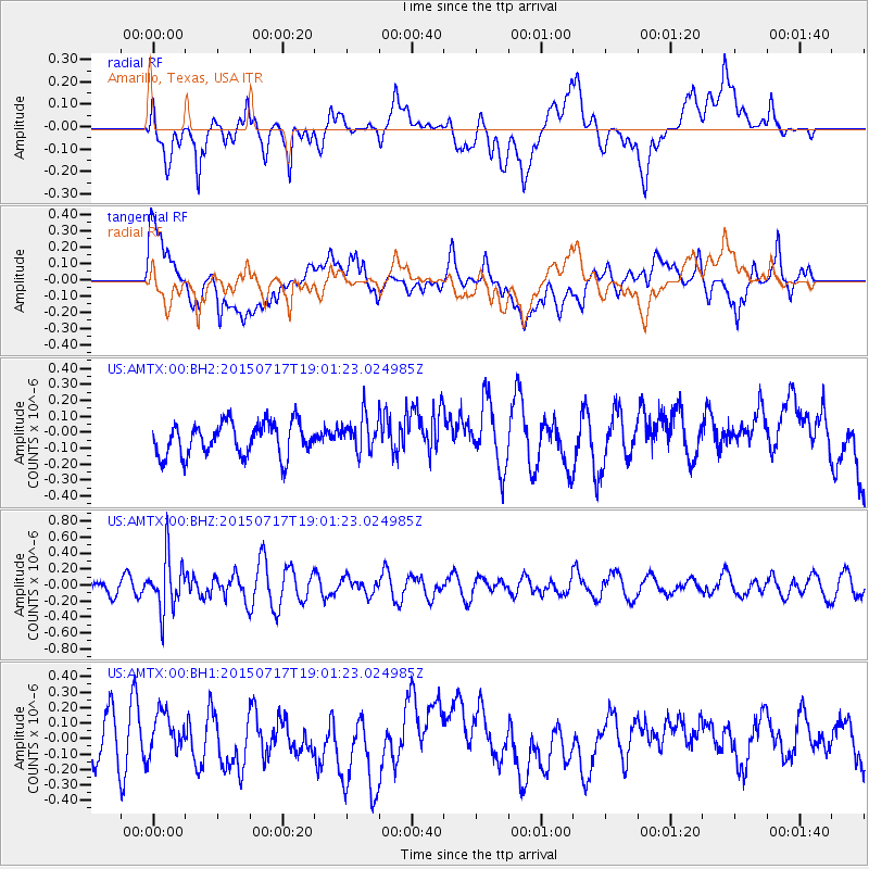
AMTX Amarillo, Texas, USA - Earthquake Result Viewer
*The percent match for this event was below the threshold and hence no stack was calculated.
| Earthquake location: |
Fiji Islands Region |
| Earthquake latitude/longitude: |
-18.1/-178.2 |
| Earthquake time(UTC): |
2015/07/17 (198) 18:49:53 GMT |
| Earthquake Depth: |
537 km |
| Earthquake Magnitude: |
5.8 MWW, 5.8 MWC, 5.9 MWB, 5.9 MWC |
| Earthquake Catalog/Contributor: |
NEIC PDE/NEIC COMCAT |
|
| Network: |
US United States National Seismic Network |
| Station: |
AMTX Amarillo, Texas, USA |
| Lat/Lon: |
34.53 N/101.41 W |
| Elevation: |
1010 m |
|
| Distance: |
89.7 deg |
| Az: |
53.491 deg |
| Baz: |
247.806 deg |
| Ray Param: |
$rayparam |
*The percent match for this event was below the threshold and hence was not used in the summary stack. |
|
| Radial Match: |
41.46341 % |
| Radial Bump: |
400 |
| Transverse Match: |
45.646763 % |
| Transverse Bump: |
400 |
| SOD ConfigId: |
1085051 |
| Insert Time: |
2015-07-31 19:01:40.248 +0000 |
| GWidth: |
2.5 |
| Max Bumps: |
400 |
| Tol: |
0.001 |
|
Signal To Noise
| Channel | StoN | STA | LTA |
| US:AMTX:00:BHZ:20150717T19:01:23.024985Z | 4.731988 | 3.3857717E-7 | 7.155072E-8 |
| US:AMTX:00:BH1:20150717T19:01:23.024985Z | 1.0150505 | 1.2700883E-7 | 1.2512562E-7 |
| US:AMTX:00:BH2:20150717T19:01:23.024985Z | 1.172756 | 1.2219762E-7 | 1.0419698E-7 |
| Arrivals |
| Ps | |
| PpPs | |
| PsPs/PpSs | |


