You are here: Home > Network List > CI - Caltech Regional Seismic Network Stations List
> Station BAR Barrett, Tecate, CA, USA > Earthquake Result Viewer
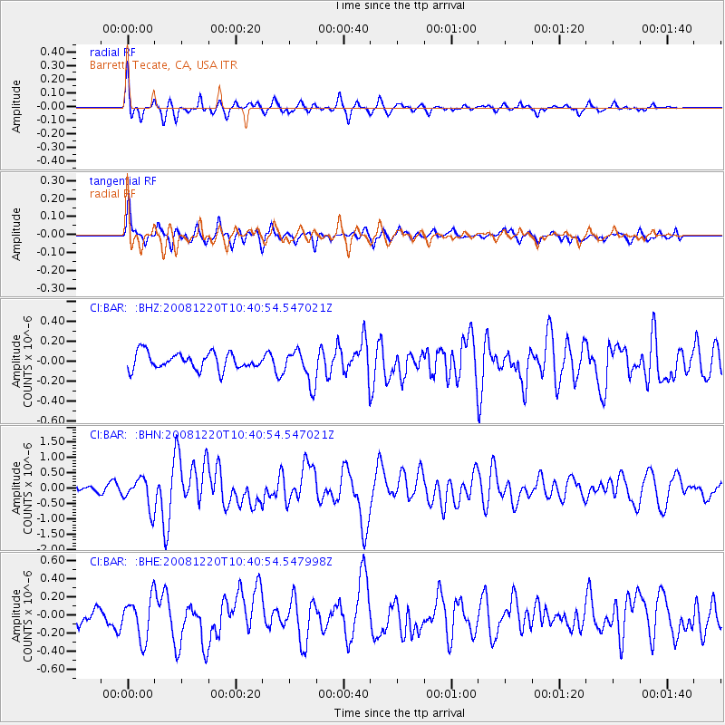
BAR Barrett, Tecate, CA, USA - Earthquake Result Viewer
*The percent match for this event was below the threshold and hence no stack was calculated.
| Earthquake location: |
Off East Coast Of Honshu, Japan |
| Earthquake latitude/longitude: |
36.5/142.4 |
| Earthquake time(UTC): |
2008/12/20 (355) 10:29:23 GMT |
| Earthquake Depth: |
19 km |
| Earthquake Magnitude: |
6.0 MB, 6.3 MS, 6.3 MW, 6.3 MW |
| Earthquake Catalog/Contributor: |
WHDF/NEIC |
|
| Network: |
CI Caltech Regional Seismic Network |
| Station: |
BAR Barrett, Tecate, CA, USA |
| Lat/Lon: |
32.68 N/116.67 W |
| Elevation: |
521 m |
|
| Distance: |
79.0 deg |
| Az: |
57.512 deg |
| Baz: |
306.342 deg |
| Ray Param: |
$rayparam |
*The percent match for this event was below the threshold and hence was not used in the summary stack. |
|
| Radial Match: |
83.44483 % |
| Radial Bump: |
316 |
| Transverse Match: |
69.17977 % |
| Transverse Bump: |
400 |
| SOD ConfigId: |
2658 |
| Insert Time: |
2010-02-26 00:11:11.145 +0000 |
| GWidth: |
2.5 |
| Max Bumps: |
400 |
| Tol: |
0.001 |
|
Signal To Noise
| Channel | StoN | STA | LTA |
| CI:BAR: :BHN:20081220T10:40:54.547021Z | 3.7047594 | 4.8802576E-7 | 1.3172941E-7 |
| CI:BAR: :BHE:20081220T10:40:54.547998Z | 2.8642402 | 2.2800033E-7 | 7.960238E-8 |
| CI:BAR: :BHZ:20081220T10:40:54.547021Z | 2.0788116 | 1.7139548E-7 | 8.244878E-8 |
| Arrivals |
| Ps | |
| PpPs | |
| PsPs/PpSs | |


