You are here: Home > Network List > US - United States National Seismic Network Stations List
> Station HAWA Hanford, Washington, USA > Earthquake Result Viewer
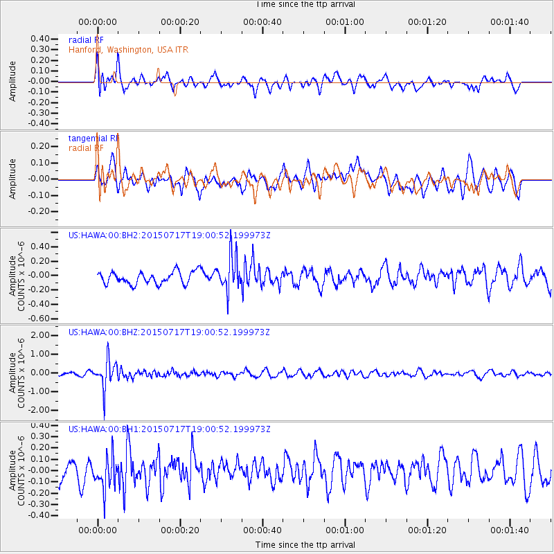
HAWA Hanford, Washington, USA - Earthquake Result Viewer
*The percent match for this event was below the threshold and hence no stack was calculated.
| Earthquake location: |
Fiji Islands Region |
| Earthquake latitude/longitude: |
-18.1/-178.2 |
| Earthquake time(UTC): |
2015/07/17 (198) 18:49:53 GMT |
| Earthquake Depth: |
537 km |
| Earthquake Magnitude: |
5.8 MWW, 5.8 MWC, 5.9 MWB, 5.9 MWC |
| Earthquake Catalog/Contributor: |
NEIC PDE/NEIC COMCAT |
|
| Network: |
US United States National Seismic Network |
| Station: |
HAWA Hanford, Washington, USA |
| Lat/Lon: |
46.39 N/119.53 W |
| Elevation: |
364 m |
|
| Distance: |
83.1 deg |
| Az: |
36.544 deg |
| Baz: |
234.904 deg |
| Ray Param: |
$rayparam |
*The percent match for this event was below the threshold and hence was not used in the summary stack. |
|
| Radial Match: |
59.858646 % |
| Radial Bump: |
400 |
| Transverse Match: |
55.122368 % |
| Transverse Bump: |
400 |
| SOD ConfigId: |
1085051 |
| Insert Time: |
2015-07-31 19:02:24.157 +0000 |
| GWidth: |
2.5 |
| Max Bumps: |
400 |
| Tol: |
0.001 |
|
Signal To Noise
| Channel | StoN | STA | LTA |
| US:HAWA:00:BHZ:20150717T19:00:52.199973Z | 4.473569 | 7.664224E-7 | 1.7132236E-7 |
| US:HAWA:00:BH1:20150717T19:00:52.199973Z | 1.4303061 | 1.4489075E-7 | 1.0130052E-7 |
| US:HAWA:00:BH2:20150717T19:00:52.199973Z | 2.9661698 | 2.5020682E-7 | 8.43535E-8 |
| Arrivals |
| Ps | |
| PpPs | |
| PsPs/PpSs | |


