You are here: Home > Network List > CI - Caltech Regional Seismic Network Stations List
> Station BAR Barrett, Tecate, CA, USA > Earthquake Result Viewer
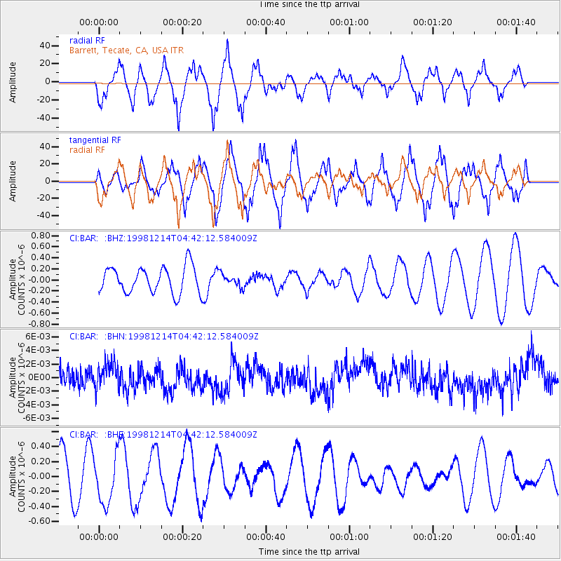
BAR Barrett, Tecate, CA, USA - Earthquake Result Viewer
*The percent match for this event was below the threshold and hence no stack was calculated.
| Earthquake location: |
Southeast Of Honshu, Japan |
| Earthquake latitude/longitude: |
30.9/137.7 |
| Earthquake time(UTC): |
1998/12/14 (348) 04:30:56 GMT |
| Earthquake Depth: |
464 km |
| Earthquake Magnitude: |
5.5 UNKNOWN, 4.9 MB |
| Earthquake Catalog/Contributor: |
WHDF/NEIC |
|
| Network: |
CI Caltech Regional Seismic Network |
| Station: |
BAR Barrett, Tecate, CA, USA |
| Lat/Lon: |
32.68 N/116.67 W |
| Elevation: |
521 m |
|
| Distance: |
85.5 deg |
| Az: |
54.541 deg |
| Baz: |
303.9 deg |
| Ray Param: |
$rayparam |
*The percent match for this event was below the threshold and hence was not used in the summary stack. |
|
| Radial Match: |
61.614223 % |
| Radial Bump: |
400 |
| Transverse Match: |
71.14789 % |
| Transverse Bump: |
376 |
| SOD ConfigId: |
4480 |
| Insert Time: |
2010-02-26 00:11:12.745 +0000 |
| GWidth: |
2.5 |
| Max Bumps: |
400 |
| Tol: |
0.001 |
|
Signal To Noise
| Channel | StoN | STA | LTA |
| CI:BAR: :BHN:19981214T04:42:12.584009Z | 1.2450956 | 1.9187594E-9 | 1.5410538E-9 |
| CI:BAR: :BHE:19981214T04:42:12.584009Z | 0.9430546 | 3.2399797E-7 | 3.4356225E-7 |
| CI:BAR: :BHZ:19981214T04:42:12.584009Z | 0.47030735 | 1.1154378E-7 | 2.3717209E-7 |
| Arrivals |
| Ps | |
| PpPs | |
| PsPs/PpSs | |


