You are here: Home > Network List > TA - USArray Transportable Network (new EarthScope stations) Stations List
> Station L44A Lake County Forest Preserve, Grayslake, IL, USA > Earthquake Result Viewer
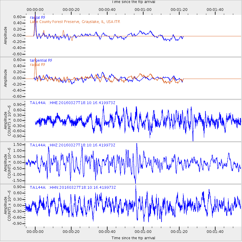
L44A Lake County Forest Preserve, Grayslake, IL, USA - Earthquake Result Viewer
*The percent match for this event was below the threshold and hence no stack was calculated.
| Earthquake location: |
Fox Islands, Aleutian Islands |
| Earthquake latitude/longitude: |
52.2/-168.7 |
| Earthquake time(UTC): |
2016/03/27 (087) 18:01:30 GMT |
| Earthquake Depth: |
16 km |
| Earthquake Magnitude: |
5.7 MWB |
| Earthquake Catalog/Contributor: |
NEIC PDE/NEIC COMCAT |
|
| Network: |
TA USArray Transportable Network (new EarthScope stations) |
| Station: |
L44A Lake County Forest Preserve, Grayslake, IL, USA |
| Lat/Lon: |
42.18 N/87.91 W |
| Elevation: |
202 m |
|
| Distance: |
53.1 deg |
| Az: |
66.537 deg |
| Baz: |
310.554 deg |
| Ray Param: |
$rayparam |
*The percent match for this event was below the threshold and hence was not used in the summary stack. |
|
| Radial Match: |
73.59453 % |
| Radial Bump: |
400 |
| Transverse Match: |
58.601414 % |
| Transverse Bump: |
400 |
| SOD ConfigId: |
7422571 |
| Insert Time: |
2019-04-22 02:34:19.275 +0000 |
| GWidth: |
2.5 |
| Max Bumps: |
400 |
| Tol: |
0.001 |
|
Signal To Noise
| Channel | StoN | STA | LTA |
| TA:L44A: :HHZ:20160327T18:10:16.419973Z | 2.5311532 | 3.6132704E-7 | 1.4275194E-7 |
| TA:L44A: :HHN:20160327T18:10:16.419973Z | 1.1916473 | 2.0973744E-7 | 1.760063E-7 |
| TA:L44A: :HHE:20160327T18:10:16.419973Z | 2.0367377 | 3.1359764E-7 | 1.5397056E-7 |
| Arrivals |
| Ps | |
| PpPs | |
| PsPs/PpSs | |


