You are here: Home > Network List > GS - US Geological Survey Networks Stations List
> Station KAN08 Pence Farm, Harper, KS, USA > Earthquake Result Viewer
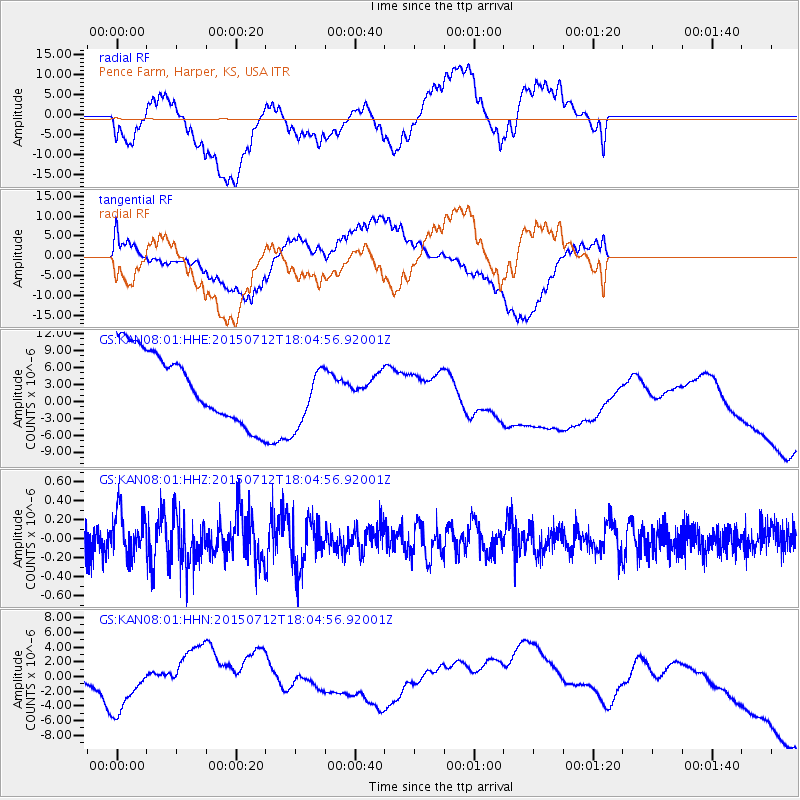
KAN08 Pence Farm, Harper, KS, USA - Earthquake Result Viewer
*The percent match for this event was below the threshold and hence no stack was calculated.
| Earthquake location: |
Kyushu, Japan |
| Earthquake latitude/longitude: |
33.0/131.8 |
| Earthquake time(UTC): |
2015/07/12 (193) 17:52:05 GMT |
| Earthquake Depth: |
47 km |
| Earthquake Magnitude: |
5.5 MB, 5.5 MWC |
| Earthquake Catalog/Contributor: |
NEIC PDE/NEIC COMCAT |
|
| Network: |
GS US Geological Survey Networks |
| Station: |
KAN08 Pence Farm, Harper, KS, USA |
| Lat/Lon: |
37.23 N/97.97 W |
| Elevation: |
375 m |
|
| Distance: |
96.1 deg |
| Az: |
37.769 deg |
| Baz: |
319.866 deg |
| Ray Param: |
$rayparam |
*The percent match for this event was below the threshold and hence was not used in the summary stack. |
|
| Radial Match: |
20.880993 % |
| Radial Bump: |
400 |
| Transverse Match: |
44.864056 % |
| Transverse Bump: |
400 |
| SOD ConfigId: |
1085051 |
| Insert Time: |
2015-07-31 20:28:04.058 +0000 |
| GWidth: |
2.5 |
| Max Bumps: |
400 |
| Tol: |
0.001 |
|
Signal To Noise
| Channel | StoN | STA | LTA |
| GS:KAN08:01:HHZ:20150712T18:04:56.92001Z | 0.9444269 | 2.3233716E-7 | 2.4600863E-7 |
| GS:KAN08:01:HHN:20150712T18:04:56.92001Z | 0.32513243 | 3.5563974E-6 | 1.0938304E-5 |
| GS:KAN08:01:HHE:20150712T18:04:56.92001Z | 0.9391633 | 5.7822076E-6 | 6.156765E-6 |
| Arrivals |
| Ps | |
| PpPs | |
| PsPs/PpSs | |


