You are here: Home > Network List > UW - Pacific Northwest Regional Seismic Network Stations List
> Station UMAT Pilot Rock, OR, USA > Earthquake Result Viewer
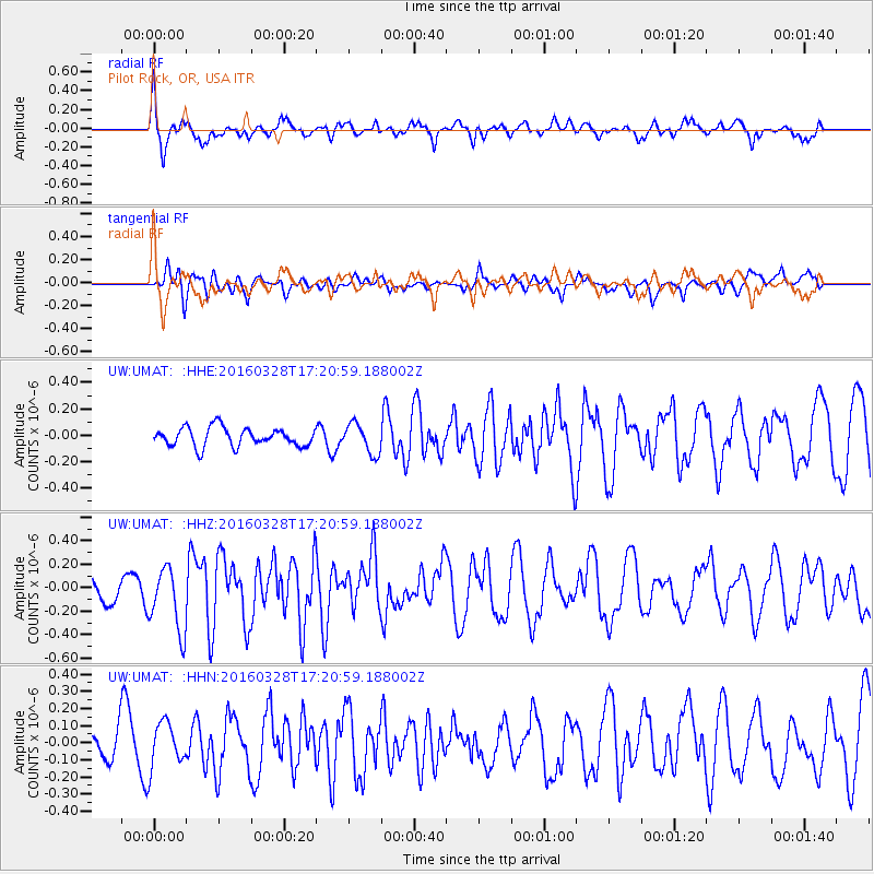
UMAT Pilot Rock, OR, USA - Earthquake Result Viewer
*The percent match for this event was below the threshold and hence no stack was calculated.
| Earthquake location: |
Fox Islands, Aleutian Islands |
| Earthquake latitude/longitude: |
52.3/-168.7 |
| Earthquake time(UTC): |
2016/03/28 (088) 17:14:55 GMT |
| Earthquake Depth: |
10 km |
| Earthquake Magnitude: |
5.5 MB, 5.6 MWC, 5.6 MWB |
| Earthquake Catalog/Contributor: |
NEIC PDE/NEIC COMCAT |
|
| Network: |
UW Pacific Northwest Regional Seismic Network |
| Station: |
UMAT Pilot Rock, OR, USA |
| Lat/Lon: |
45.29 N/118.96 W |
| Elevation: |
1318 m |
|
| Distance: |
32.9 deg |
| Az: |
82.096 deg |
| Baz: |
300.504 deg |
| Ray Param: |
$rayparam |
*The percent match for this event was below the threshold and hence was not used in the summary stack. |
|
| Radial Match: |
73.38248 % |
| Radial Bump: |
400 |
| Transverse Match: |
48.12852 % |
| Transverse Bump: |
400 |
| SOD ConfigId: |
7422571 |
| Insert Time: |
2019-04-22 02:49:58.076 +0000 |
| GWidth: |
2.5 |
| Max Bumps: |
400 |
| Tol: |
0.001 |
|
Signal To Noise
| Channel | StoN | STA | LTA |
| UW:UMAT: :HHZ:20160328T17:20:59.188002Z | 2.5583808 | 2.7090073E-7 | 1.05887565E-7 |
| UW:UMAT: :HHN:20160328T17:20:59.188002Z | 0.9613782 | 1.30627E-7 | 1.3587471E-7 |
| UW:UMAT: :HHE:20160328T17:20:59.188002Z | 1.6283798 | 1.1397911E-7 | 6.999541E-8 |
| Arrivals |
| Ps | |
| PpPs | |
| PsPs/PpSs | |


