You are here: Home > Network List > US - United States National Seismic Network Stations List
> Station AGMN Agassiz National Wildlife Refuge, Minnesota, USA > Earthquake Result Viewer
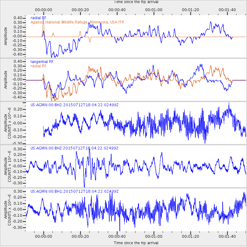
AGMN Agassiz National Wildlife Refuge, Minnesota, USA - Earthquake Result Viewer
*The percent match for this event was below the threshold and hence no stack was calculated.
| Earthquake location: |
Kyushu, Japan |
| Earthquake latitude/longitude: |
33.0/131.8 |
| Earthquake time(UTC): |
2015/07/12 (193) 17:52:05 GMT |
| Earthquake Depth: |
47 km |
| Earthquake Magnitude: |
5.5 MB, 5.5 MWC |
| Earthquake Catalog/Contributor: |
NEIC PDE/NEIC COMCAT |
|
| Network: |
US United States National Seismic Network |
| Station: |
AGMN Agassiz National Wildlife Refuge, Minnesota, USA |
| Lat/Lon: |
48.30 N/95.86 W |
| Elevation: |
351 m |
|
| Distance: |
88.5 deg |
| Az: |
29.564 deg |
| Baz: |
321.634 deg |
| Ray Param: |
$rayparam |
*The percent match for this event was below the threshold and hence was not used in the summary stack. |
|
| Radial Match: |
31.782667 % |
| Radial Bump: |
400 |
| Transverse Match: |
45.64353 % |
| Transverse Bump: |
400 |
| SOD ConfigId: |
1085051 |
| Insert Time: |
2015-07-31 20:31:34.493 +0000 |
| GWidth: |
2.5 |
| Max Bumps: |
400 |
| Tol: |
0.001 |
|
Signal To Noise
| Channel | StoN | STA | LTA |
| US:AGMN:00:BHZ:20150712T18:04:22.02499Z | 0.77515197 | 6.4043505E-8 | 8.262059E-8 |
| US:AGMN:00:BH1:20150712T18:04:22.02499Z | 0.7041682 | 1.0304779E-7 | 1.4633973E-7 |
| US:AGMN:00:BH2:20150712T18:04:22.02499Z | 1.1785945 | 9.4145825E-8 | 7.987975E-8 |
| Arrivals |
| Ps | |
| PpPs | |
| PsPs/PpSs | |


