You are here: Home > Network List > AV - Alaska Volcano Observatory Stations List
> Station SPCR Ckakachatna River, Mount Spurr, Alaska > Earthquake Result Viewer
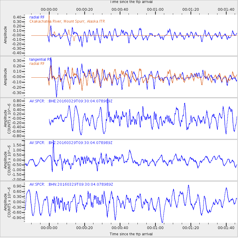
SPCR Ckakachatna River, Mount Spurr, Alaska - Earthquake Result Viewer
*The percent match for this event was below the threshold and hence no stack was calculated.
| Earthquake location: |
Northern Molucca Sea |
| Earthquake latitude/longitude: |
2.4/126.1 |
| Earthquake time(UTC): |
2016/03/29 (089) 09:18:11 GMT |
| Earthquake Depth: |
57 km |
| Earthquake Magnitude: |
5.5 MWB |
| Earthquake Catalog/Contributor: |
NEIC PDE/NEIC COMCAT |
|
| Network: |
AV Alaska Volcano Observatory |
| Station: |
SPCR Ckakachatna River, Mount Spurr, Alaska |
| Lat/Lon: |
61.20 N/152.21 W |
| Elevation: |
984 m |
|
| Distance: |
83.9 deg |
| Az: |
28.806 deg |
| Baz: |
263.849 deg |
| Ray Param: |
$rayparam |
*The percent match for this event was below the threshold and hence was not used in the summary stack. |
|
| Radial Match: |
55.122425 % |
| Radial Bump: |
400 |
| Transverse Match: |
55.463192 % |
| Transverse Bump: |
400 |
| SOD ConfigId: |
7422571 |
| Insert Time: |
2019-04-22 02:56:23.168 +0000 |
| GWidth: |
2.5 |
| Max Bumps: |
400 |
| Tol: |
0.001 |
|
Signal To Noise
| Channel | StoN | STA | LTA |
| AV:SPCR: :BHZ:20160329T09:30:04.078989Z | 1.9851294 | 6.5433056E-7 | 3.2961609E-7 |
| AV:SPCR: :BHN:20160329T09:30:04.078989Z | 0.9055108 | 3.8657475E-7 | 4.2691346E-7 |
| AV:SPCR: :BHE:20160329T09:30:04.078989Z | 1.6007279 | 4.4576188E-7 | 2.784745E-7 |
| Arrivals |
| Ps | |
| PpPs | |
| PsPs/PpSs | |


