You are here: Home > Network List > CN - Canadian National Seismograph Network Stations List
> Station INK INUVIK, NT > Earthquake Result Viewer
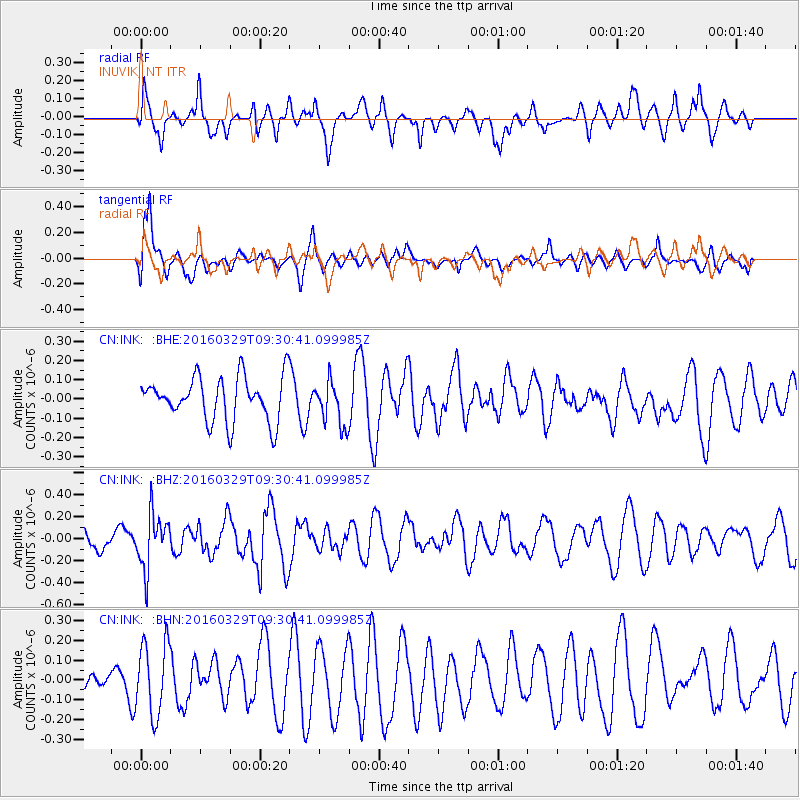
INK INUVIK, NT - Earthquake Result Viewer
*The percent match for this event was below the threshold and hence no stack was calculated.
| Earthquake location: |
Northern Molucca Sea |
| Earthquake latitude/longitude: |
2.4/126.1 |
| Earthquake time(UTC): |
2016/03/29 (089) 09:18:11 GMT |
| Earthquake Depth: |
57 km |
| Earthquake Magnitude: |
5.5 MWB |
| Earthquake Catalog/Contributor: |
NEIC PDE/NEIC COMCAT |
|
| Network: |
CN Canadian National Seismograph Network |
| Station: |
INK INUVIK, NT |
| Lat/Lon: |
68.31 N/133.53 W |
| Elevation: |
44 m |
|
| Distance: |
91.7 deg |
| Az: |
21.461 deg |
| Baz: |
280.505 deg |
| Ray Param: |
$rayparam |
*The percent match for this event was below the threshold and hence was not used in the summary stack. |
|
| Radial Match: |
57.506645 % |
| Radial Bump: |
400 |
| Transverse Match: |
64.44943 % |
| Transverse Bump: |
400 |
| SOD ConfigId: |
7422571 |
| Insert Time: |
2019-04-22 02:56:42.831 +0000 |
| GWidth: |
2.5 |
| Max Bumps: |
400 |
| Tol: |
0.001 |
|
Signal To Noise
| Channel | StoN | STA | LTA |
| CN:INK: :BHZ:20160329T09:30:41.099985Z | 1.7137505 | 2.468645E-7 | 1.4404925E-7 |
| CN:INK: :BHN:20160329T09:30:41.099985Z | 2.3748908 | 1.8350065E-7 | 7.726698E-8 |
| CN:INK: :BHE:20160329T09:30:41.099985Z | 0.9965489 | 1.1374133E-7 | 1.1413522E-7 |
| Arrivals |
| Ps | |
| PpPs | |
| PsPs/PpSs | |


