You are here: Home > Network List > TA - USArray Transportable Network (new EarthScope stations) Stations List
> Station A21K Barrow, AK, USA > Earthquake Result Viewer
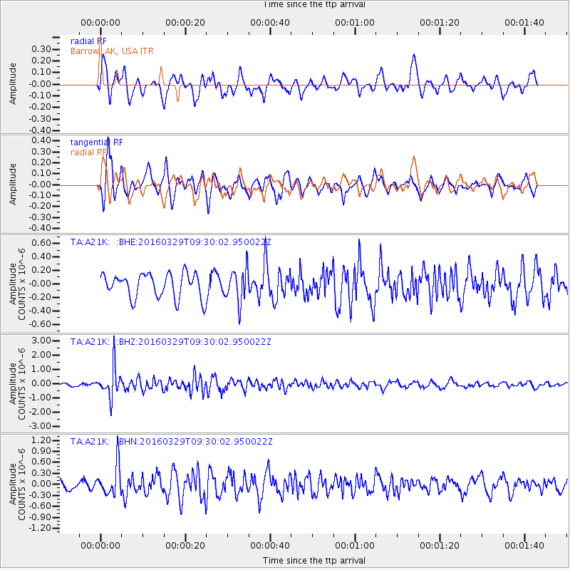
A21K Barrow, AK, USA - Earthquake Result Viewer
*The percent match for this event was below the threshold and hence no stack was calculated.
| Earthquake location: |
Northern Molucca Sea |
| Earthquake latitude/longitude: |
2.4/126.1 |
| Earthquake time(UTC): |
2016/03/29 (089) 09:18:11 GMT |
| Earthquake Depth: |
57 km |
| Earthquake Magnitude: |
5.5 MWB |
| Earthquake Catalog/Contributor: |
NEIC PDE/NEIC COMCAT |
|
| Network: |
TA USArray Transportable Network (new EarthScope stations) |
| Station: |
A21K Barrow, AK, USA |
| Lat/Lon: |
71.32 N/156.62 W |
| Elevation: |
577 m |
|
| Distance: |
83.7 deg |
| Az: |
18.432 deg |
| Baz: |
258.684 deg |
| Ray Param: |
$rayparam |
*The percent match for this event was below the threshold and hence was not used in the summary stack. |
|
| Radial Match: |
68.694725 % |
| Radial Bump: |
400 |
| Transverse Match: |
71.75222 % |
| Transverse Bump: |
400 |
| SOD ConfigId: |
7422571 |
| Insert Time: |
2019-04-22 02:58:24.961 +0000 |
| GWidth: |
2.5 |
| Max Bumps: |
400 |
| Tol: |
0.001 |
|
Signal To Noise
| Channel | StoN | STA | LTA |
| TA:A21K: :BHZ:20160329T09:30:02.950022Z | 9.969823 | 1.0465881E-6 | 1.04975584E-7 |
| TA:A21K: :BHN:20160329T09:30:02.950022Z | 3.4702053 | 4.2878995E-7 | 1.2356327E-7 |
| TA:A21K: :BHE:20160329T09:30:02.950022Z | 1.3582573 | 2.451516E-7 | 1.804898E-7 |
| Arrivals |
| Ps | |
| PpPs | |
| PsPs/PpSs | |


