You are here: Home > Network List > CN - Canadian National Seismograph Network Stations List
> Station FRB IQALUIT, N.W.T. > Earthquake Result Viewer
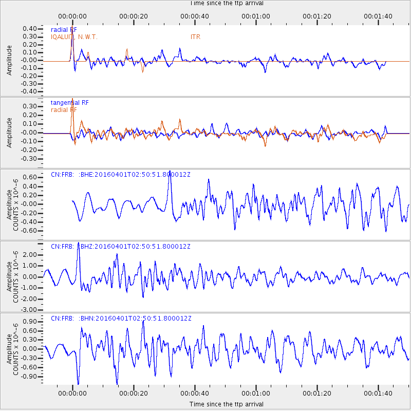
FRB IQALUIT, N.W.T. - Earthquake Result Viewer
*The percent match for this event was below the threshold and hence no stack was calculated.
| Earthquake location: |
Near S. Coast Of Western Honshu |
| Earthquake latitude/longitude: |
33.4/136.4 |
| Earthquake time(UTC): |
2016/04/01 (092) 02:39:07 GMT |
| Earthquake Depth: |
10 km |
| Earthquake Magnitude: |
6.0 MWP |
| Earthquake Catalog/Contributor: |
NEIC PDE/NEIC COMCAT |
|
| Network: |
CN Canadian National Seismograph Network |
| Station: |
FRB IQALUIT, N.W.T. |
| Lat/Lon: |
63.75 N/68.55 W |
| Elevation: |
18 m |
|
| Distance: |
81.2 deg |
| Az: |
10.947 deg |
| Baz: |
339.065 deg |
| Ray Param: |
$rayparam |
*The percent match for this event was below the threshold and hence was not used in the summary stack. |
|
| Radial Match: |
66.13236 % |
| Radial Bump: |
400 |
| Transverse Match: |
70.62623 % |
| Transverse Bump: |
400 |
| SOD ConfigId: |
7422571 |
| Insert Time: |
2019-04-22 03:03:27.140 +0000 |
| GWidth: |
2.5 |
| Max Bumps: |
400 |
| Tol: |
0.001 |
|
Signal To Noise
| Channel | StoN | STA | LTA |
| CN:FRB: :BHZ:20160401T02:50:51.800012Z | 2.59336 | 1.231134E-6 | 4.7472548E-7 |
| CN:FRB: :BHN:20160401T02:50:51.800012Z | 3.672751 | 4.9584736E-7 | 1.3500707E-7 |
| CN:FRB: :BHE:20160401T02:50:51.800012Z | 2.4457927 | 3.377464E-7 | 1.380928E-7 |
| Arrivals |
| Ps | |
| PpPs | |
| PsPs/PpSs | |


