You are here: Home > Network List > TA - USArray Transportable Network (new EarthScope stations) Stations List
> Station ABTX Abilene, Hawley, TX, USA > Earthquake Result Viewer
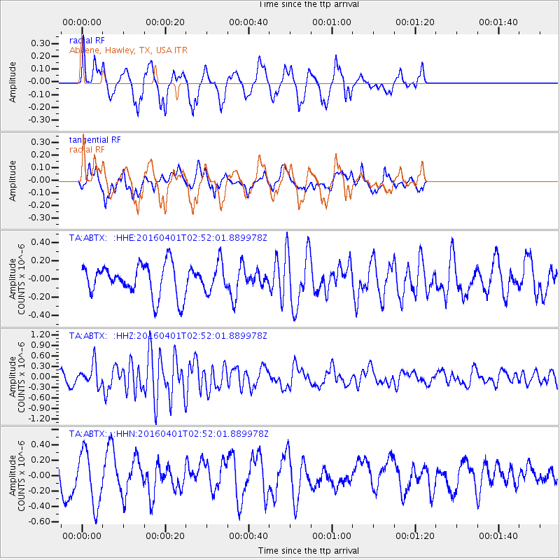
ABTX Abilene, Hawley, TX, USA - Earthquake Result Viewer
*The percent match for this event was below the threshold and hence no stack was calculated.
| Earthquake location: |
Near S. Coast Of Western Honshu |
| Earthquake latitude/longitude: |
33.4/136.4 |
| Earthquake time(UTC): |
2016/04/01 (092) 02:39:07 GMT |
| Earthquake Depth: |
10 km |
| Earthquake Magnitude: |
6.0 MWP |
| Earthquake Catalog/Contributor: |
NEIC PDE/NEIC COMCAT |
|
| Network: |
TA USArray Transportable Network (new EarthScope stations) |
| Station: |
ABTX Abilene, Hawley, TX, USA |
| Lat/Lon: |
32.62 N/99.64 W |
| Elevation: |
502 m |
|
| Distance: |
95.8 deg |
| Az: |
44.718 deg |
| Baz: |
315.755 deg |
| Ray Param: |
$rayparam |
*The percent match for this event was below the threshold and hence was not used in the summary stack. |
|
| Radial Match: |
65.91239 % |
| Radial Bump: |
336 |
| Transverse Match: |
60.857086 % |
| Transverse Bump: |
400 |
| SOD ConfigId: |
7422571 |
| Insert Time: |
2019-04-22 03:07:37.672 +0000 |
| GWidth: |
2.5 |
| Max Bumps: |
400 |
| Tol: |
0.001 |
|
Signal To Noise
| Channel | StoN | STA | LTA |
| TA:ABTX: :HHZ:20160401T02:52:01.889978Z | 2.6262624 | 3.0950898E-7 | 1.1785151E-7 |
| TA:ABTX: :HHN:20160401T02:52:01.889978Z | 2.1877003 | 3.5584193E-7 | 1.6265571E-7 |
| TA:ABTX: :HHE:20160401T02:52:01.889978Z | 0.9267489 | 1.6379259E-7 | 1.7673892E-7 |
| Arrivals |
| Ps | |
| PpPs | |
| PsPs/PpSs | |


