You are here: Home > Network List > TA - USArray Transportable Network (new EarthScope stations) Stations List
> Station L19K White Mountain, AK, USA > Earthquake Result Viewer
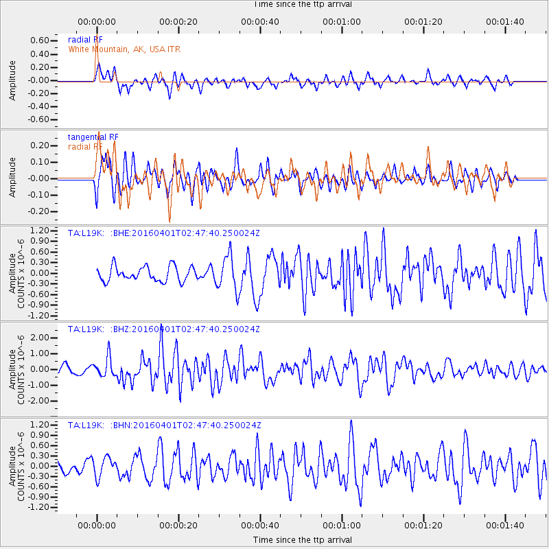
L19K White Mountain, AK, USA - Earthquake Result Viewer
*The percent match for this event was below the threshold and hence no stack was calculated.
| Earthquake location: |
Near S. Coast Of Western Honshu |
| Earthquake latitude/longitude: |
33.4/136.4 |
| Earthquake time(UTC): |
2016/04/01 (092) 02:39:07 GMT |
| Earthquake Depth: |
10 km |
| Earthquake Magnitude: |
6.0 MWP |
| Earthquake Catalog/Contributor: |
NEIC PDE/NEIC COMCAT |
|
| Network: |
TA USArray Transportable Network (new EarthScope stations) |
| Station: |
L19K White Mountain, AK, USA |
| Lat/Lon: |
62.18 N/154.85 W |
| Elevation: |
650 m |
|
| Distance: |
51.3 deg |
| Az: |
34.095 deg |
| Baz: |
269.178 deg |
| Ray Param: |
$rayparam |
*The percent match for this event was below the threshold and hence was not used in the summary stack. |
|
| Radial Match: |
63.693966 % |
| Radial Bump: |
400 |
| Transverse Match: |
63.605644 % |
| Transverse Bump: |
400 |
| SOD ConfigId: |
7422571 |
| Insert Time: |
2019-04-22 03:08:01.197 +0000 |
| GWidth: |
2.5 |
| Max Bumps: |
400 |
| Tol: |
0.001 |
|
Signal To Noise
| Channel | StoN | STA | LTA |
| TA:L19K: :BHZ:20160401T02:47:40.250024Z | 2.7145612 | 6.2895515E-7 | 2.3169679E-7 |
| TA:L19K: :BHN:20160401T02:47:40.250024Z | 1.2885487 | 2.8519162E-7 | 2.2132777E-7 |
| TA:L19K: :BHE:20160401T02:47:40.250024Z | 2.4334373 | 4.9422454E-7 | 2.0309729E-7 |
| Arrivals |
| Ps | |
| PpPs | |
| PsPs/PpSs | |


