You are here: Home > Network List > CI - Caltech Regional Seismic Network Stations List
> Station BAR Barrett, Tecate, CA, USA > Earthquake Result Viewer
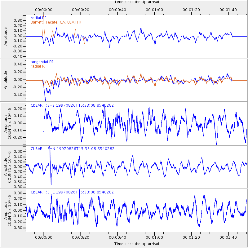
BAR Barrett, Tecate, CA, USA - Earthquake Result Viewer
*The percent match for this event was below the threshold and hence no stack was calculated.
| Earthquake location: |
South Of Fiji Islands |
| Earthquake latitude/longitude: |
-25.5/178.3 |
| Earthquake time(UTC): |
1997/08/26 (238) 15:22:09 GMT |
| Earthquake Depth: |
610 km |
| Earthquake Magnitude: |
5.5 MB, 5.7 UNKNOWN |
| Earthquake Catalog/Contributor: |
WHDF/NEIC |
|
| Network: |
CI Caltech Regional Seismic Network |
| Station: |
BAR Barrett, Tecate, CA, USA |
| Lat/Lon: |
32.68 N/116.67 W |
| Elevation: |
521 m |
|
| Distance: |
84.7 deg |
| Az: |
50.135 deg |
| Baz: |
235.328 deg |
| Ray Param: |
$rayparam |
*The percent match for this event was below the threshold and hence was not used in the summary stack. |
|
| Radial Match: |
56.661747 % |
| Radial Bump: |
400 |
| Transverse Match: |
68.55253 % |
| Transverse Bump: |
400 |
| SOD ConfigId: |
4480 |
| Insert Time: |
2010-02-26 00:11:49.649 +0000 |
| GWidth: |
2.5 |
| Max Bumps: |
400 |
| Tol: |
0.001 |
|
Signal To Noise
| Channel | StoN | STA | LTA |
| CI:BAR: :BHN:19970826T15:33:08.854028Z | 2.9148135 | 3.0949144E-7 | 1.0617881E-7 |
| CI:BAR: :BHE:19970826T15:33:08.854028Z | 1.004269 | 1.0272379E-7 | 1.0228712E-7 |
| CI:BAR: :BHZ:19970826T15:33:08.854028Z | 1.05471 | 1.065683E-7 | 1.0104038E-7 |
| Arrivals |
| Ps | |
| PpPs | |
| PsPs/PpSs | |


