You are here: Home > Network List > AZ - ANZA Regional Network Stations List
> Station SMER AZ.SMER > Earthquake Result Viewer
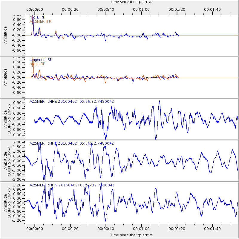
SMER AZ.SMER - Earthquake Result Viewer
*The percent match for this event was below the threshold and hence no stack was calculated.
| Earthquake location: |
Alaska Peninsula |
| Earthquake latitude/longitude: |
57.0/-158.0 |
| Earthquake time(UTC): |
2016/04/02 (093) 05:50:00 GMT |
| Earthquake Depth: |
10 km |
| Earthquake Magnitude: |
6.2 MWP, 6.4 MI |
| Earthquake Catalog/Contributor: |
NEIC PDE/NEIC COMCAT |
|
| Network: |
AZ ANZA Regional Network |
| Station: |
SMER AZ.SMER |
| Lat/Lon: |
33.46 N/117.17 W |
| Elevation: |
355 m |
|
| Distance: |
36.3 deg |
| Az: |
112.854 deg |
| Baz: |
322.951 deg |
| Ray Param: |
$rayparam |
*The percent match for this event was below the threshold and hence was not used in the summary stack. |
|
| Radial Match: |
72.308945 % |
| Radial Bump: |
325 |
| Transverse Match: |
66.2307 % |
| Transverse Bump: |
400 |
| SOD ConfigId: |
7422571 |
| Insert Time: |
2019-04-22 03:17:04.265 +0000 |
| GWidth: |
2.5 |
| Max Bumps: |
400 |
| Tol: |
0.001 |
|
Signal To Noise
| Channel | StoN | STA | LTA |
| AZ:SMER: :HHZ:20160402T05:56:32.748004Z | 1.7580937 | 9.1277934E-7 | 5.19187E-7 |
| AZ:SMER: :HHN:20160402T05:56:32.748004Z | 1.1723486 | 3.836861E-7 | 3.272799E-7 |
| AZ:SMER: :HHE:20160402T05:56:32.748004Z | 2.4350388 | 3.3386831E-7 | 1.3711005E-7 |
| Arrivals |
| Ps | |
| PpPs | |
| PsPs/PpSs | |


