You are here: Home > Network List > CI - Caltech Regional Seismic Network Stations List
> Station MUR Murrieta > Earthquake Result Viewer
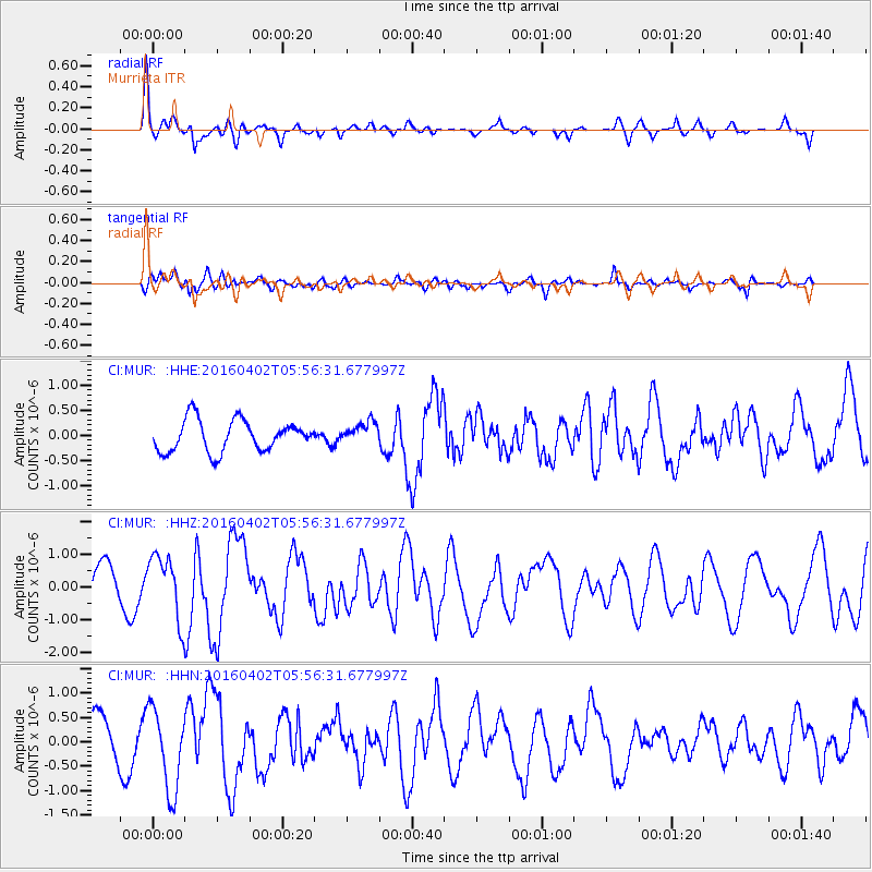
MUR Murrieta - Earthquake Result Viewer
*The percent match for this event was below the threshold and hence no stack was calculated.
| Earthquake location: |
Alaska Peninsula |
| Earthquake latitude/longitude: |
57.0/-158.0 |
| Earthquake time(UTC): |
2016/04/02 (093) 05:50:00 GMT |
| Earthquake Depth: |
10 km |
| Earthquake Magnitude: |
6.2 MWP, 6.4 MI |
| Earthquake Catalog/Contributor: |
NEIC PDE/NEIC COMCAT |
|
| Network: |
CI Caltech Regional Seismic Network |
| Station: |
MUR Murrieta |
| Lat/Lon: |
33.60 N/117.20 W |
| Elevation: |
562 m |
|
| Distance: |
36.2 deg |
| Az: |
112.737 deg |
| Baz: |
322.843 deg |
| Ray Param: |
$rayparam |
*The percent match for this event was below the threshold and hence was not used in the summary stack. |
|
| Radial Match: |
76.67779 % |
| Radial Bump: |
400 |
| Transverse Match: |
70.553 % |
| Transverse Bump: |
400 |
| SOD ConfigId: |
7422571 |
| Insert Time: |
2019-04-22 03:17:57.002 +0000 |
| GWidth: |
2.5 |
| Max Bumps: |
400 |
| Tol: |
0.001 |
|
Signal To Noise
| Channel | StoN | STA | LTA |
| CI:MUR: :HHZ:20160402T05:56:31.677997Z | 1.4070264 | 1.0117886E-6 | 7.1909716E-7 |
| CI:MUR: :HHN:20160402T05:56:31.677997Z | 1.6020415 | 8.319387E-7 | 5.192991E-7 |
| CI:MUR: :HHE:20160402T05:56:31.677997Z | 0.8117874 | 2.5019477E-7 | 3.0820232E-7 |
| Arrivals |
| Ps | |
| PpPs | |
| PsPs/PpSs | |


