You are here: Home > Network List > CI - Caltech Regional Seismic Network Stations List
> Station BAR Barrett, Tecate, CA, USA > Earthquake Result Viewer
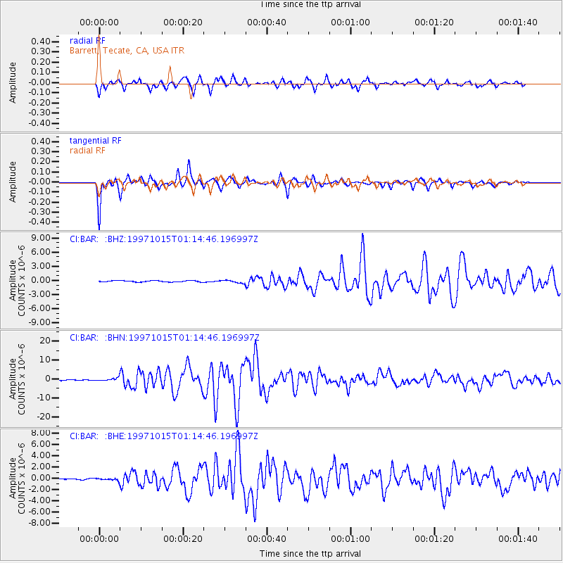
BAR Barrett, Tecate, CA, USA - Earthquake Result Viewer
*The percent match for this event was below the threshold and hence no stack was calculated.
| Earthquake location: |
Near Coast Of Central Chile |
| Earthquake latitude/longitude: |
-30.9/-71.2 |
| Earthquake time(UTC): |
1997/10/15 (288) 01:03:33 GMT |
| Earthquake Depth: |
58 km |
| Earthquake Magnitude: |
6.8 MB, 6.8 MS, 7.3 UNKNOWN, 7.1 MW |
| Earthquake Catalog/Contributor: |
WHDF/NEIC |
|
| Network: |
CI Caltech Regional Seismic Network |
| Station: |
BAR Barrett, Tecate, CA, USA |
| Lat/Lon: |
32.68 N/116.67 W |
| Elevation: |
521 m |
|
| Distance: |
76.5 deg |
| Az: |
321.822 deg |
| Baz: |
140.965 deg |
| Ray Param: |
$rayparam |
*The percent match for this event was below the threshold and hence was not used in the summary stack. |
|
| Radial Match: |
90.93012 % |
| Radial Bump: |
400 |
| Transverse Match: |
93.42663 % |
| Transverse Bump: |
346 |
| SOD ConfigId: |
4480 |
| Insert Time: |
2010-02-26 00:12:11.849 +0000 |
| GWidth: |
2.5 |
| Max Bumps: |
400 |
| Tol: |
0.001 |
|
Signal To Noise
| Channel | StoN | STA | LTA |
| CI:BAR: :BHN:19971015T01:14:46.196997Z | 5.5970993 | 8.071228E-7 | 1.4420377E-7 |
| CI:BAR: :BHE:19971015T01:14:46.196997Z | 1.4204202 | 1.9418003E-7 | 1.3670605E-7 |
| CI:BAR: :BHZ:19971015T01:14:46.196997Z | 2.1482575 | 3.1450585E-7 | 1.4640045E-7 |
| Arrivals |
| Ps | |
| PpPs | |
| PsPs/PpSs | |


