You are here: Home > Network List > TA - USArray Transportable Network (new EarthScope stations) Stations List
> Station H17A Grant Village (NPS), Yellowstone Nt. Park, WY, USA > Earthquake Result Viewer
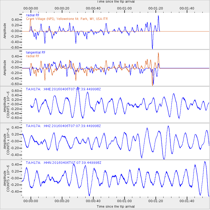
H17A Grant Village (NPS), Yellowstone Nt. Park, WY, USA - Earthquake Result Viewer
*The percent match for this event was below the threshold and hence no stack was calculated.
| Earthquake location: |
Vanuatu Islands |
| Earthquake latitude/longitude: |
-14.2/166.7 |
| Earthquake time(UTC): |
2016/04/06 (097) 06:54:53 GMT |
| Earthquake Depth: |
35 km |
| Earthquake Magnitude: |
5.8 MWW |
| Earthquake Catalog/Contributor: |
NEIC PDE/NEIC COMCAT |
|
| Network: |
TA USArray Transportable Network (new EarthScope stations) |
| Station: |
H17A Grant Village (NPS), Yellowstone Nt. Park, WY, USA |
| Lat/Lon: |
44.40 N/110.58 W |
| Elevation: |
2400 m |
|
| Distance: |
94.7 deg |
| Az: |
45.517 deg |
| Baz: |
254.889 deg |
| Ray Param: |
$rayparam |
*The percent match for this event was below the threshold and hence was not used in the summary stack. |
|
| Radial Match: |
65.70536 % |
| Radial Bump: |
354 |
| Transverse Match: |
50.779976 % |
| Transverse Bump: |
352 |
| SOD ConfigId: |
7422571 |
| Insert Time: |
2019-04-22 03:47:10.657 +0000 |
| GWidth: |
2.5 |
| Max Bumps: |
400 |
| Tol: |
0.001 |
|
Signal To Noise
| Channel | StoN | STA | LTA |
| TA:H17A: :HHZ:20160406T07:07:39.449998Z | 0.6346231 | 9.5422436E-8 | 1.503608E-7 |
| TA:H17A: :HHN:20160406T07:07:39.449998Z | 1.0043395 | 1.8988932E-7 | 1.8906886E-7 |
| TA:H17A: :HHE:20160406T07:07:39.449998Z | 2.0772836 | 4.860247E-7 | 2.3397128E-7 |
| Arrivals |
| Ps | |
| PpPs | |
| PsPs/PpSs | |


