You are here: Home > Network List > UW - Pacific Northwest Regional Seismic Network Stations List
> Station PASS Maple Falls, WA, USA > Earthquake Result Viewer
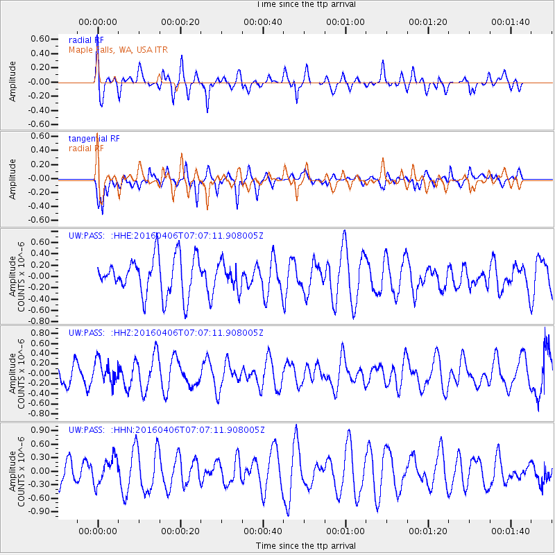
PASS Maple Falls, WA, USA - Earthquake Result Viewer
*The percent match for this event was below the threshold and hence no stack was calculated.
| Earthquake location: |
Vanuatu Islands |
| Earthquake latitude/longitude: |
-14.2/166.7 |
| Earthquake time(UTC): |
2016/04/06 (097) 06:54:53 GMT |
| Earthquake Depth: |
35 km |
| Earthquake Magnitude: |
5.8 MWW |
| Earthquake Catalog/Contributor: |
NEIC PDE/NEIC COMCAT |
|
| Network: |
UW Pacific Northwest Regional Seismic Network |
| Station: |
PASS Maple Falls, WA, USA |
| Lat/Lon: |
49.00 N/122.09 W |
| Elevation: |
174 m |
|
| Distance: |
88.7 deg |
| Az: |
38.584 deg |
| Baz: |
246.723 deg |
| Ray Param: |
$rayparam |
*The percent match for this event was below the threshold and hence was not used in the summary stack. |
|
| Radial Match: |
46.563316 % |
| Radial Bump: |
400 |
| Transverse Match: |
55.130165 % |
| Transverse Bump: |
375 |
| SOD ConfigId: |
7422571 |
| Insert Time: |
2019-04-22 03:47:50.138 +0000 |
| GWidth: |
2.5 |
| Max Bumps: |
400 |
| Tol: |
0.001 |
|
Signal To Noise
| Channel | StoN | STA | LTA |
| UW:PASS: :HHZ:20160406T07:07:11.908005Z | 1.1213343 | 2.2415533E-7 | 1.9990054E-7 |
| UW:PASS: :HHN:20160406T07:07:11.908005Z | 0.9294488 | 2.9207524E-7 | 3.1424565E-7 |
| UW:PASS: :HHE:20160406T07:07:11.908005Z | 0.6973535 | 2.3272717E-7 | 3.3372913E-7 |
| Arrivals |
| Ps | |
| PpPs | |
| PsPs/PpSs | |


