You are here: Home > Network List > US - United States National Seismic Network Stations List
> Station LKWY Lake (Yellowstone--Lake), Wyoming, USA > Earthquake Result Viewer
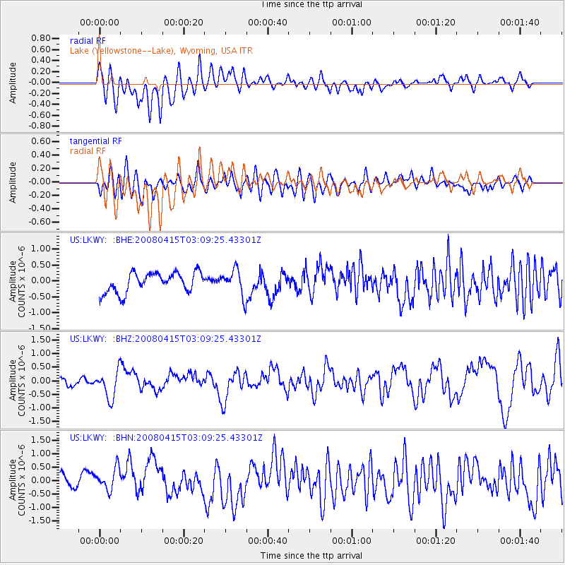
LKWY Lake (Yellowstone--Lake), Wyoming, USA - Earthquake Result Viewer
*The percent match for this event was below the threshold and hence no stack was calculated.
| Earthquake location: |
Near Coast Of Guatemala |
| Earthquake latitude/longitude: |
13.6/-90.6 |
| Earthquake time(UTC): |
2008/04/15 (106) 03:03:04 GMT |
| Earthquake Depth: |
33 km |
| Earthquake Magnitude: |
5.6 MB, 5.8 MS, 6.1 MW, 6.1 MW |
| Earthquake Catalog/Contributor: |
WHDF/NEIC |
|
| Network: |
US United States National Seismic Network |
| Station: |
LKWY Lake (Yellowstone--Lake), Wyoming, USA |
| Lat/Lon: |
44.57 N/110.40 W |
| Elevation: |
2424 m |
|
| Distance: |
35.2 deg |
| Az: |
335.17 deg |
| Baz: |
145.16 deg |
| Ray Param: |
$rayparam |
*The percent match for this event was below the threshold and hence was not used in the summary stack. |
|
| Radial Match: |
55.25691 % |
| Radial Bump: |
400 |
| Transverse Match: |
60.33161 % |
| Transverse Bump: |
400 |
| SOD ConfigId: |
2504 |
| Insert Time: |
2010-03-05 00:56:56.163 +0000 |
| GWidth: |
2.5 |
| Max Bumps: |
400 |
| Tol: |
0.001 |
|
Signal To Noise
| Channel | StoN | STA | LTA |
| US:LKWY: :BHZ:20080415T03:09:25.43301Z | 4.087176 | 5.3139667E-7 | 1.3001561E-7 |
| US:LKWY: :BHN:20080415T03:09:25.43301Z | 2.096482 | 4.797414E-7 | 2.2883165E-7 |
| US:LKWY: :BHE:20080415T03:09:25.43301Z | 1.3792907 | 4.2703724E-7 | 3.096064E-7 |
| Arrivals |
| Ps | |
| PpPs | |
| PsPs/PpSs | |


