You are here: Home > Network List > US - United States National Seismic Network Stations List
> Station LKWY Lake (Yellowstone--Lake), Wyoming, USA > Earthquake Result Viewer
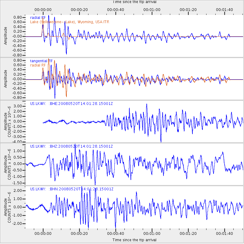
LKWY Lake (Yellowstone--Lake), Wyoming, USA - Earthquake Result Viewer
*The percent match for this event was below the threshold and hence no stack was calculated.
| Earthquake location: |
Rat Islands, Aleutian Islands |
| Earthquake latitude/longitude: |
51.2/178.8 |
| Earthquake time(UTC): |
2008/05/20 (141) 13:53:35 GMT |
| Earthquake Depth: |
27 km |
| Earthquake Magnitude: |
5.8 MB, 6.0 MS, 6.3 MW, 6.3 MW |
| Earthquake Catalog/Contributor: |
WHDF/NEIC |
|
| Network: |
US United States National Seismic Network |
| Station: |
LKWY Lake (Yellowstone--Lake), Wyoming, USA |
| Lat/Lon: |
44.57 N/110.40 W |
| Elevation: |
2424 m |
|
| Distance: |
46.3 deg |
| Az: |
69.081 deg |
| Baz: |
304.63 deg |
| Ray Param: |
$rayparam |
*The percent match for this event was below the threshold and hence was not used in the summary stack. |
|
| Radial Match: |
76.14976 % |
| Radial Bump: |
400 |
| Transverse Match: |
65.140755 % |
| Transverse Bump: |
400 |
| SOD ConfigId: |
2504 |
| Insert Time: |
2010-03-05 00:57:18.221 +0000 |
| GWidth: |
2.5 |
| Max Bumps: |
400 |
| Tol: |
0.001 |
|
Signal To Noise
| Channel | StoN | STA | LTA |
| US:LKWY: :BHZ:20080520T14:01:28.15001Z | 3.5769289 | 4.270195E-7 | 1.1938161E-7 |
| US:LKWY: :BHN:20080520T14:01:28.15001Z | 1.970444 | 3.3919662E-7 | 1.7214224E-7 |
| US:LKWY: :BHE:20080520T14:01:28.15001Z | 1.4253728 | 2.2883837E-7 | 1.6054632E-7 |
| Arrivals |
| Ps | |
| PpPs | |
| PsPs/PpSs | |


