You are here: Home > Network List > US - United States National Seismic Network Stations List
> Station LKWY Lake (Yellowstone--Lake), Wyoming, USA > Earthquake Result Viewer
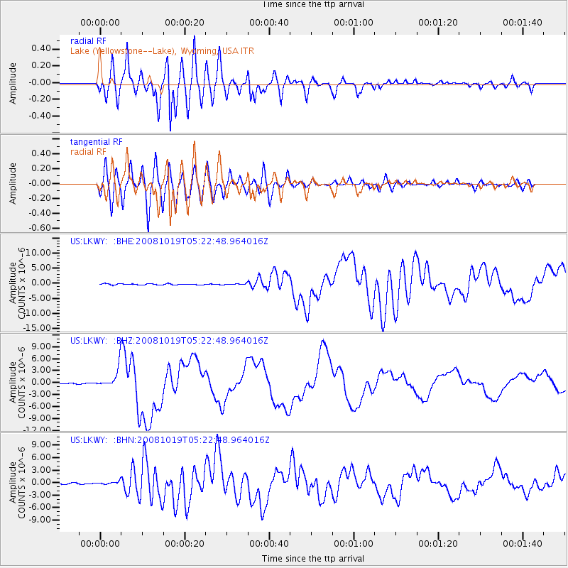
LKWY Lake (Yellowstone--Lake), Wyoming, USA - Earthquake Result Viewer
*The percent match for this event was below the threshold and hence no stack was calculated.
| Earthquake location: |
Tonga Islands |
| Earthquake latitude/longitude: |
-21.9/-173.8 |
| Earthquake time(UTC): |
2008/10/19 (293) 05:10:33 GMT |
| Earthquake Depth: |
29 km |
| Earthquake Magnitude: |
6.8 MB, 7.0 MS, 6.9 MW, 6.9 MW |
| Earthquake Catalog/Contributor: |
WHDF/NEIC |
|
| Network: |
US United States National Seismic Network |
| Station: |
LKWY Lake (Yellowstone--Lake), Wyoming, USA |
| Lat/Lon: |
44.57 N/110.40 W |
| Elevation: |
2424 m |
|
| Distance: |
87.8 deg |
| Az: |
39.771 deg |
| Baz: |
236.238 deg |
| Ray Param: |
$rayparam |
*The percent match for this event was below the threshold and hence was not used in the summary stack. |
|
| Radial Match: |
85.72484 % |
| Radial Bump: |
400 |
| Transverse Match: |
88.38495 % |
| Transverse Bump: |
400 |
| SOD ConfigId: |
2560 |
| Insert Time: |
2010-03-05 00:58:14.865 +0000 |
| GWidth: |
2.5 |
| Max Bumps: |
400 |
| Tol: |
0.001 |
|
Signal To Noise
| Channel | StoN | STA | LTA |
| US:LKWY: :BHZ:20081019T05:22:48.964016Z | 22.20841 | 2.6591645E-6 | 1.1973681E-7 |
| US:LKWY: :BHN:20081019T05:22:48.964016Z | 2.1241174 | 3.5649109E-7 | 1.6783022E-7 |
| US:LKWY: :BHE:20081019T05:22:48.964016Z | 1.0021422 | 1.897688E-7 | 1.8936315E-7 |
| Arrivals |
| Ps | |
| PpPs | |
| PsPs/PpSs | |


