You are here: Home > Network List > CI - Caltech Regional Seismic Network Stations List
> Station BAR Barrett, Tecate, CA, USA > Earthquake Result Viewer
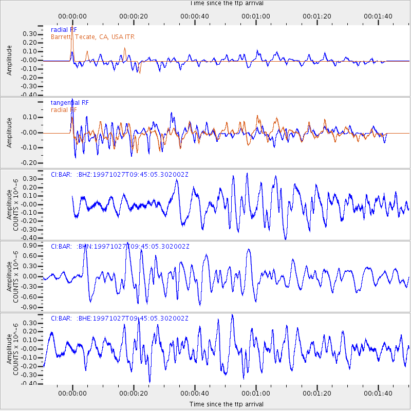
BAR Barrett, Tecate, CA, USA - Earthquake Result Viewer
*The percent match for this event was below the threshold and hence no stack was calculated.
| Earthquake location: |
Kermadec Islands, New Zealand |
| Earthquake latitude/longitude: |
-30.8/-178.5 |
| Earthquake time(UTC): |
1997/10/27 (300) 09:32:59 GMT |
| Earthquake Depth: |
33 km |
| Earthquake Magnitude: |
5.5 MB, 5.4 MS |
| Earthquake Catalog/Contributor: |
WHDF/NEIC |
|
| Network: |
CI Caltech Regional Seismic Network |
| Station: |
BAR Barrett, Tecate, CA, USA |
| Lat/Lon: |
32.68 N/116.67 W |
| Elevation: |
521 m |
|
| Distance: |
86.0 deg |
| Az: |
48.151 deg |
| Baz: |
229.496 deg |
| Ray Param: |
$rayparam |
*The percent match for this event was below the threshold and hence was not used in the summary stack. |
|
| Radial Match: |
50.754673 % |
| Radial Bump: |
400 |
| Transverse Match: |
57.576912 % |
| Transverse Bump: |
400 |
| SOD ConfigId: |
4480 |
| Insert Time: |
2010-02-26 00:12:18.898 +0000 |
| GWidth: |
2.5 |
| Max Bumps: |
400 |
| Tol: |
0.001 |
|
Signal To Noise
| Channel | StoN | STA | LTA |
| CI:BAR: :BHN:19971027T09:45:05.302002Z | 3.527725 | 3.6564336E-7 | 1.0364849E-7 |
| CI:BAR: :BHE:19971027T09:45:05.302002Z | 0.6271046 | 8.162019E-8 | 1.3015404E-7 |
| CI:BAR: :BHZ:19971027T09:45:05.302002Z | 2.3817773 | 1.4485518E-7 | 6.08181E-8 |
| Arrivals |
| Ps | |
| PpPs | |
| PsPs/PpSs | |


