You are here: Home > Network List > US - United States National Seismic Network Stations List
> Station LKWY Lake (Yellowstone--Lake), Wyoming, USA > Earthquake Result Viewer
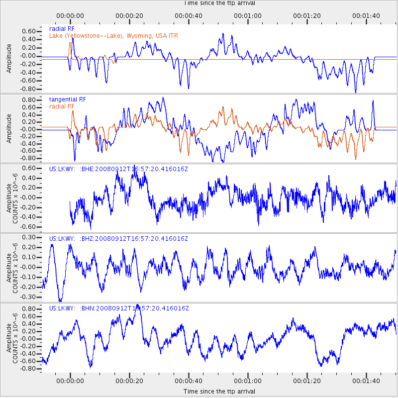
LKWY Lake (Yellowstone--Lake), Wyoming, USA - Earthquake Result Viewer
*The percent match for this event was below the threshold and hence no stack was calculated.
| Earthquake location: |
Southeast Of Loyalty Islands |
| Earthquake latitude/longitude: |
-21.7/170.5 |
| Earthquake time(UTC): |
2008/09/12 (256) 16:44:30 GMT |
| Earthquake Depth: |
116 km |
| Earthquake Magnitude: |
5.8 MW, 5.4 MB, 5.8 MW |
| Earthquake Catalog/Contributor: |
WHDF/NEIC |
|
| Network: |
US United States National Seismic Network |
| Station: |
LKWY Lake (Yellowstone--Lake), Wyoming, USA |
| Lat/Lon: |
44.57 N/110.40 W |
| Elevation: |
2424 m |
|
| Distance: |
97.6 deg |
| Az: |
45.083 deg |
| Baz: |
247.132 deg |
| Ray Param: |
$rayparam |
*The percent match for this event was below the threshold and hence was not used in the summary stack. |
|
| Radial Match: |
54.886337 % |
| Radial Bump: |
400 |
| Transverse Match: |
46.66015 % |
| Transverse Bump: |
400 |
| SOD ConfigId: |
2504 |
| Insert Time: |
2010-03-05 00:58:26.668 +0000 |
| GWidth: |
2.5 |
| Max Bumps: |
400 |
| Tol: |
0.001 |
|
Signal To Noise
| Channel | StoN | STA | LTA |
| US:LKWY: :BHZ:20080912T16:57:20.416016Z | 0.7619155 | 1.1156237E-7 | 1.4642355E-7 |
| US:LKWY: :BHN:20080912T16:57:20.416016Z | 1.1447325 | 3.7311142E-7 | 3.2593763E-7 |
| US:LKWY: :BHE:20080912T16:57:20.416016Z | 0.80339706 | 2.3365176E-7 | 2.9082975E-7 |
| Arrivals |
| Ps | |
| PpPs | |
| PsPs/PpSs | |


