You are here: Home > Network List > CI - Caltech Regional Seismic Network Stations List
> Station BAR Barrett, Tecate, CA, USA > Earthquake Result Viewer
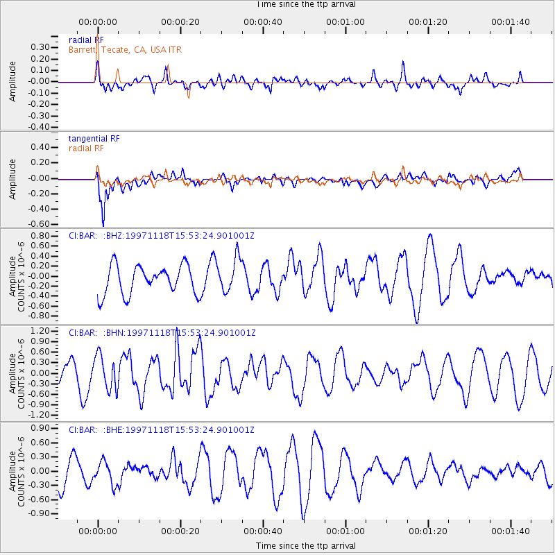
BAR Barrett, Tecate, CA, USA - Earthquake Result Viewer
*The percent match for this event was below the threshold and hence no stack was calculated.
| Earthquake location: |
Kermadec Islands, New Zealand |
| Earthquake latitude/longitude: |
-29.1/-177.7 |
| Earthquake time(UTC): |
1997/11/18 (322) 15:41:29 GMT |
| Earthquake Depth: |
52 km |
| Earthquake Magnitude: |
5.7 MB, 5.5 MS |
| Earthquake Catalog/Contributor: |
WHDF/NEIC |
|
| Network: |
CI Caltech Regional Seismic Network |
| Station: |
BAR Barrett, Tecate, CA, USA |
| Lat/Lon: |
32.68 N/116.67 W |
| Elevation: |
521 m |
|
| Distance: |
84.3 deg |
| Az: |
47.823 deg |
| Baz: |
230.294 deg |
| Ray Param: |
$rayparam |
*The percent match for this event was below the threshold and hence was not used in the summary stack. |
|
| Radial Match: |
50.491695 % |
| Radial Bump: |
400 |
| Transverse Match: |
64.322365 % |
| Transverse Bump: |
394 |
| SOD ConfigId: |
4480 |
| Insert Time: |
2010-02-26 00:12:31.705 +0000 |
| GWidth: |
2.5 |
| Max Bumps: |
400 |
| Tol: |
0.001 |
|
Signal To Noise
| Channel | StoN | STA | LTA |
| CI:BAR: :BHN:19971118T15:53:24.901001Z | 1.5503716 | 4.9127374E-7 | 3.168748E-7 |
| CI:BAR: :BHE:19971118T15:53:24.901001Z | 1.0401986 | 2.6325068E-7 | 2.5307736E-7 |
| CI:BAR: :BHZ:19971118T15:53:24.901001Z | 1.1863316 | 3.4052275E-7 | 2.8703843E-7 |
| Arrivals |
| Ps | |
| PpPs | |
| PsPs/PpSs | |


