You are here: Home > Network List > CI - Caltech Regional Seismic Network Stations List
> Station BAR Barrett, Tecate, CA, USA > Earthquake Result Viewer
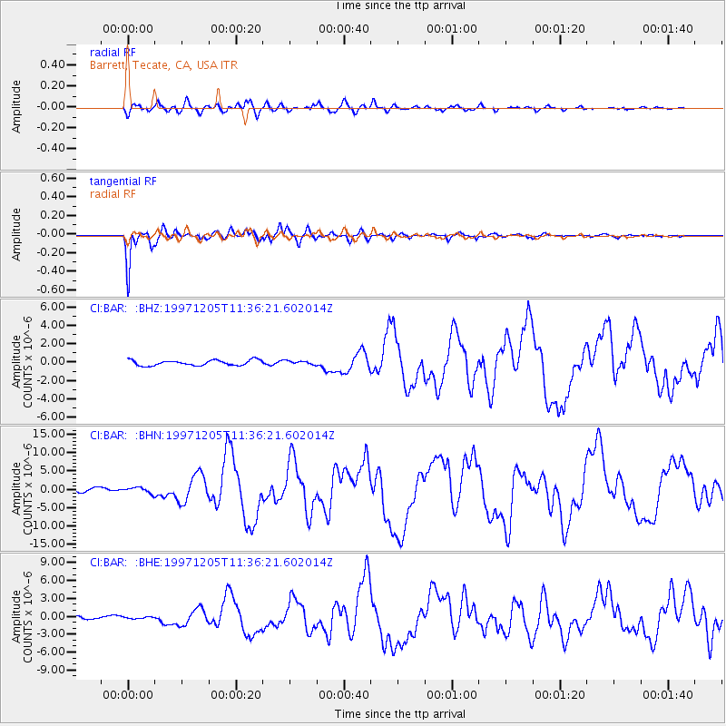
BAR Barrett, Tecate, CA, USA - Earthquake Result Viewer
*The percent match for this event was below the threshold and hence no stack was calculated.
| Earthquake location: |
Near East Coast Of Kamchatka |
| Earthquake latitude/longitude: |
54.8/162.0 |
| Earthquake time(UTC): |
1997/12/05 (339) 11:26:54 GMT |
| Earthquake Depth: |
33 km |
| Earthquake Magnitude: |
6.3 MB, 7.6 MS, 7.9 UNKNOWN, 7.3 ME |
| Earthquake Catalog/Contributor: |
WHDF/NEIC |
|
| Network: |
CI Caltech Regional Seismic Network |
| Station: |
BAR Barrett, Tecate, CA, USA |
| Lat/Lon: |
32.68 N/116.67 W |
| Elevation: |
521 m |
|
| Distance: |
59.2 deg |
| Az: |
76.074 deg |
| Baz: |
318.262 deg |
| Ray Param: |
$rayparam |
*The percent match for this event was below the threshold and hence was not used in the summary stack. |
|
| Radial Match: |
92.32684 % |
| Radial Bump: |
400 |
| Transverse Match: |
96.385826 % |
| Transverse Bump: |
330 |
| SOD ConfigId: |
4480 |
| Insert Time: |
2010-02-26 00:12:32.917 +0000 |
| GWidth: |
2.5 |
| Max Bumps: |
400 |
| Tol: |
0.001 |
|
Signal To Noise
| Channel | StoN | STA | LTA |
| CI:BAR: :BHN:19971205T11:36:21.602014Z | 1.5581305 | 7.843653E-7 | 5.034015E-7 |
| CI:BAR: :BHE:19971205T11:36:21.602014Z | 0.7514103 | 1.4819622E-7 | 1.9722408E-7 |
| CI:BAR: :BHZ:19971205T11:36:21.602014Z | 0.6848472 | 1.9673963E-7 | 2.8727524E-7 |
| Arrivals |
| Ps | |
| PpPs | |
| PsPs/PpSs | |


