MIAR Mount Ida, Arkansas, USA - Earthquake Result Viewer
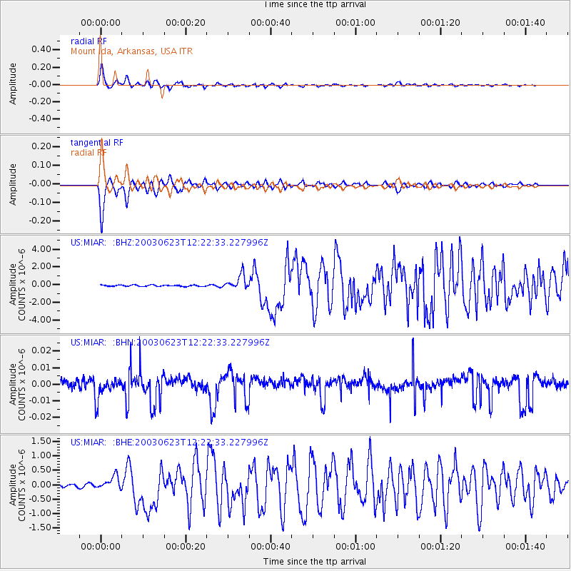
Earthquake location: Rat Islands, Aleutian Islands
Earthquake latitude/longitude: 51.4/176.8
Earthquake time(UTC): 2003/06/23 (174) 12:12:34 GMT
Earthquake Depth: 20 km
Earthquake Magnitude: 6.3 MB, 7.0 MS, 6.9 MW, 6.8 MW
Earthquake Catalog/Contributor: WHDF/NEIC
Network: US United States National Seismic Network
Station: MIAR Mount Ida, Arkansas, USA
Lat/Lon: 34.55 N/93.58 W
Elevation: 207 m
Distance: 63.7 deg
Az: 67.065 deg
Baz: 315.708 deg
Ray Param: 0.059402447
Estimated Moho Depth: 43.0 km
Estimated Crust Vp/Vs: 1.91
Assumed Crust Vp: 6.498 km/s
Estimated Crust Vs: 3.406 km/s
Estimated Crust Poisson's Ratio: 0.31
Radial Match: 95.22457 %
Radial Bump: 395
Transverse Match: 95.26134 %
Transverse Bump: 400
SOD ConfigId: 110177
Insert Time: 2010-03-05 01:01:09.623 +0000
GWidth: 2.5
Max Bumps: 400
Tol: 0.001

Signal To Noise

ChannelStoNSTALTA
US:MIAR: :BHN:20030623T12:22:33.227996Z0.8052725.80076E-97.2034796E-9
US:MIAR: :BHE:20030623T12:22:33.227996Z4.64791972.4692932E-75.3126847E-8
US:MIAR: :BHZ:20030623T12:22:33.227996Z11.157718.545408E-77.658747E-8
Arrivals
Ps6.3 SECOND
PpPs18 SECOND
PsPs/PpSs25 SECOND