You are here: Home > Network List > TA - USArray Transportable Network (new EarthScope stations) Stations List
> Station I23K Minto, Yukon-Koyukuk, AK, USA > Earthquake Result Viewer
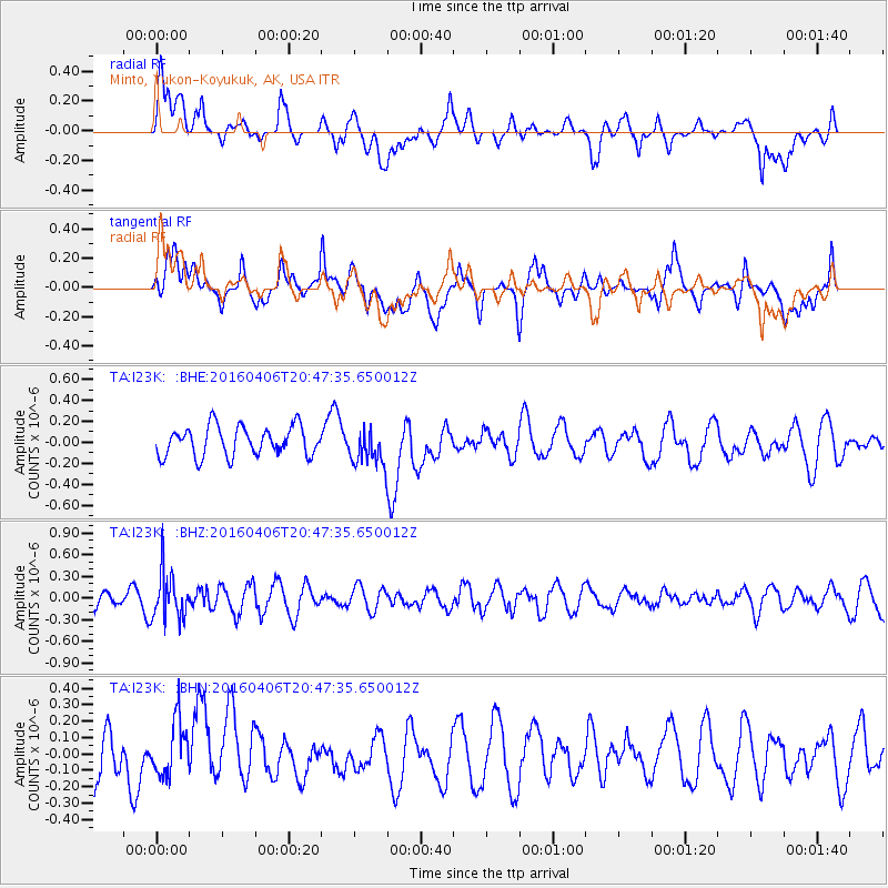
I23K Minto, Yukon-Koyukuk, AK, USA - Earthquake Result Viewer
*The percent match for this event was below the threshold and hence no stack was calculated.
| Earthquake location: |
Banda Sea |
| Earthquake latitude/longitude: |
-6.0/130.4 |
| Earthquake time(UTC): |
2016/04/06 (097) 20:35:15 GMT |
| Earthquake Depth: |
126 km |
| Earthquake Magnitude: |
5.5 MWC, 5.5 MWB, 5.5 MWC, 5.5 MWW |
| Earthquake Catalog/Contributor: |
NEIC PDE/NEIC COMCAT |
|
| Network: |
TA USArray Transportable Network (new EarthScope stations) |
| Station: |
I23K Minto, Yukon-Koyukuk, AK, USA |
| Lat/Lon: |
65.15 N/149.36 W |
| Elevation: |
149 m |
|
| Distance: |
91.3 deg |
| Az: |
24.616 deg |
| Baz: |
258.596 deg |
| Ray Param: |
$rayparam |
*The percent match for this event was below the threshold and hence was not used in the summary stack. |
|
| Radial Match: |
55.66262 % |
| Radial Bump: |
400 |
| Transverse Match: |
57.76374 % |
| Transverse Bump: |
400 |
| SOD ConfigId: |
7422571 |
| Insert Time: |
2019-04-22 04:14:24.127 +0000 |
| GWidth: |
2.5 |
| Max Bumps: |
400 |
| Tol: |
0.001 |
|
Signal To Noise
| Channel | StoN | STA | LTA |
| TA:I23K: :BHZ:20160406T20:47:35.650012Z | 3.2724524 | 3.1613692E-7 | 9.6605504E-8 |
| TA:I23K: :BHN:20160406T20:47:35.650012Z | 0.94894785 | 1.7274203E-7 | 1.8203534E-7 |
| TA:I23K: :BHE:20160406T20:47:35.650012Z | 1.2489338 | 1.7431503E-7 | 1.3957109E-7 |
| Arrivals |
| Ps | |
| PpPs | |
| PsPs/PpSs | |


