You are here: Home > Network List > II - Global Seismograph Network (GSN - IRIS/IDA) Stations List
> Station PFO Pinon Flat, California, USA > Earthquake Result Viewer
PFO Pinon Flat, California, USA - Earthquake Result Viewer
*The percent match for this event was below the threshold and hence no stack was calculated.
| Earthquake location: |
Vanuatu Islands |
| Earthquake latitude/longitude: |
-14.1/166.3 |
| Earthquake time(UTC): |
2009/10/12 (285) 20:59:38 GMT |
| Earthquake Depth: |
35 km |
| Earthquake Magnitude: |
5.7 MW, 5.4 MS, 5.2 MB, 5.7 MW |
| Earthquake Catalog/Contributor: |
WHDF/NEIC |
|
| Network: |
II Global Seismograph Network (GSN - IRIS/IDA) |
| Station: |
PFO Pinon Flat, California, USA |
| Lat/Lon: |
33.61 N/116.46 W |
| Elevation: |
1280 m |
|
| Distance: |
87.4 deg |
| Az: |
54.578 deg |
| Baz: |
251.361 deg |
| Ray Param: |
$rayparam |
*The percent match for this event was below the threshold and hence was not used in the summary stack. |
|
| Radial Match: |
62.63 % |
| Radial Bump: |
400 |
| Transverse Match: |
65.77451 % |
| Transverse Bump: |
400 |
| SOD ConfigId: |
1 |
| Insert Time: |
2010-02-19 00:43:20.089 +0000 |
| GWidth: |
2.5 |
| Max Bumps: |
400 |
| Tol: |
0.001 |
|
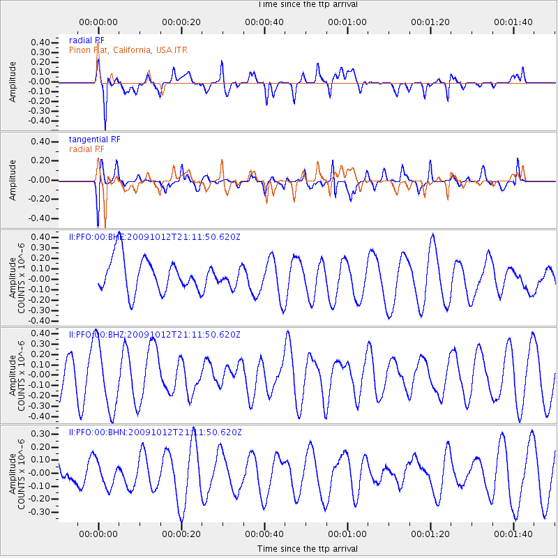
Signal To Noise
| Channel | StoN | STA | LTA |
| II:PFO:00:BHZ:20091012T21:11:50.620Z | 2.896421 | 3.265288E-7 | 1.1273527E-7 |
| II:PFO:00:BHN:20091012T21:11:50.620Z | 0.66365033 | 1.0065326E-7 | 1.516661E-7 |
| II:PFO:00:BHE:20091012T21:11:50.620Z | 0.53000104 | 8.787171E-8 | 1.6579537E-7 |
| Arrivals |
| Ps | |
| PpPs | |
| PsPs/PpSs | |


