You are here: Home > Network List > US - United States National Seismic Network Stations List
> Station DGMT Dagmar, Montana, USA > Earthquake Result Viewer
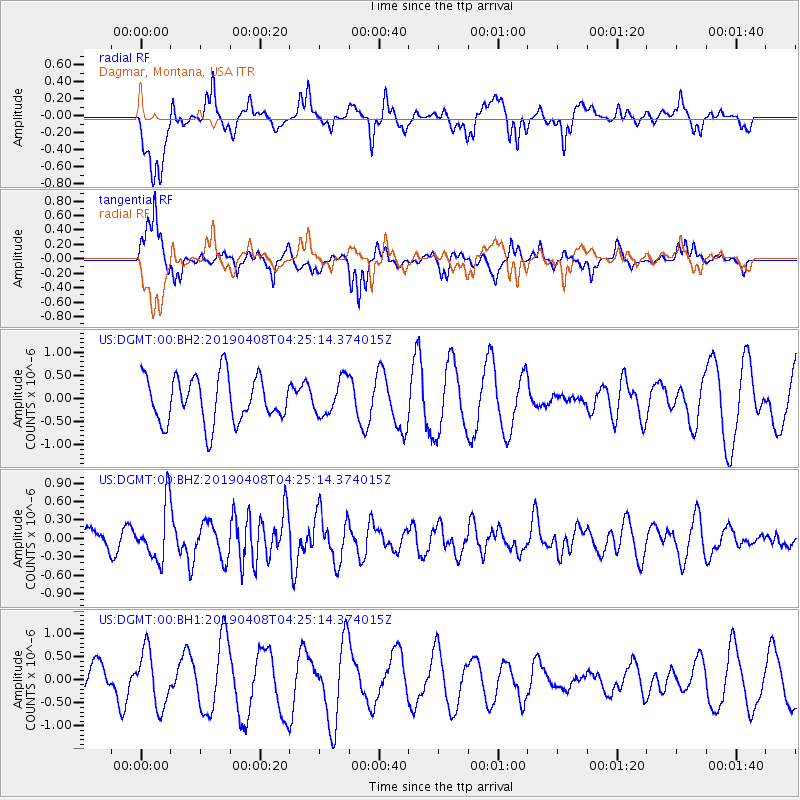
DGMT Dagmar, Montana, USA - Earthquake Result Viewer
*The percent match for this event was below the threshold and hence no stack was calculated.
| Earthquake location: |
Ryukyu Islands, Japan |
| Earthquake latitude/longitude: |
26.3/129.6 |
| Earthquake time(UTC): |
2019/04/08 (098) 04:12:40 GMT |
| Earthquake Depth: |
10 km |
| Earthquake Magnitude: |
5.5 Mww |
| Earthquake Catalog/Contributor: |
NEIC PDE/us |
|
| Network: |
US United States National Seismic Network |
| Station: |
DGMT Dagmar, Montana, USA |
| Lat/Lon: |
48.47 N/104.20 W |
| Elevation: |
0.0 m |
|
| Distance: |
91.4 deg |
| Az: |
32.484 deg |
| Baz: |
313.594 deg |
| Ray Param: |
$rayparam |
*The percent match for this event was below the threshold and hence was not used in the summary stack. |
|
| Radial Match: |
46.23199 % |
| Radial Bump: |
400 |
| Transverse Match: |
63.179962 % |
| Transverse Bump: |
338 |
| SOD ConfigId: |
9915651 |
| Insert Time: |
2019-04-22 04:18:54.583 +0000 |
| GWidth: |
2.5 |
| Max Bumps: |
400 |
| Tol: |
0.001 |
|
Signal To Noise
| Channel | StoN | STA | LTA |
| US:DGMT:00:BHZ:20190408T04:25:14.374015Z | 2.0926983 | 4.464055E-7 | 2.1331576E-7 |
| US:DGMT:00:BH1:20190408T04:25:14.374015Z | 1.3561971 | 6.0333207E-7 | 4.4487047E-7 |
| US:DGMT:00:BH2:20190408T04:25:14.374015Z | 0.77731466 | 3.864768E-7 | 4.971948E-7 |
| Arrivals |
| Ps | |
| PpPs | |
| PsPs/PpSs | |


