MIAR Mount Ida, Arkansas, USA - Earthquake Result Viewer
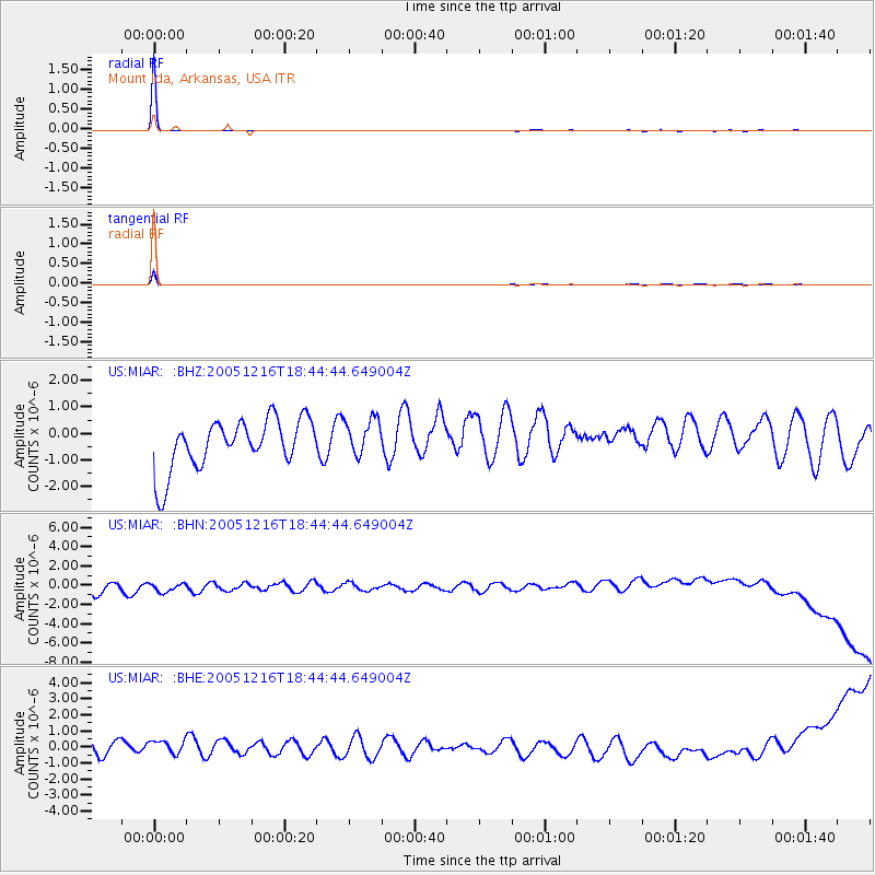
Earthquake location: Near East Coast Of Honshu, Japan
Earthquake latitude/longitude: 38.5/141.9
Earthquake time(UTC): 2005/12/16 (350) 18:32:16 GMT
Earthquake Depth: 43 km
Earthquake Magnitude: 5.8 MB, 5.6 MS, 6.0 MW, 5.9 MW
Earthquake Catalog/Contributor: WHDF/NEIC
Network: US United States National Seismic Network
Station: MIAR Mount Ida, Arkansas, USA
Lat/Lon: 34.55 N/93.58 W
Elevation: 207 m
Distance: 91.0 deg
Az: 42.858 deg
Baz: 319.722 deg
Ray Param: 0.0416288
Estimated Moho Depth: 10.0 km
Estimated Crust Vp/Vs: 1.60
Assumed Crust Vp: 6.498 km/s
Estimated Crust Vs: 4.061 km/s
Estimated Crust Poisson's Ratio: 0.18
Radial Match: 99.68336 %
Radial Bump: 41
Transverse Match: 98.81573 %
Transverse Bump: 60
SOD ConfigId: 110165
Insert Time: 2010-03-05 01:03:39.680 +0000
GWidth: 2.5
Max Bumps: 400
Tol: 0.001

Signal To Noise

ChannelStoNSTALTA
US:MIAR: :BHN:20051216T18:44:44.649004Z0.938091937.500443E-77.995424E-7
US:MIAR: :BHE:20051216T18:44:44.649004Z1.10275476.0374504E-75.4748807E-7
US:MIAR: :BHZ:20051216T18:44:44.649004Z0.752863477.1116887E-79.446187E-7
Arrivals
Ps0.9 SECOND
PpPs3.9 SECOND
PsPs/PpSs4.9 SECOND