You are here: Home > Network List > TA - USArray Transportable Network (new EarthScope stations) Stations List
> Station A21K Barrow, AK, USA > Earthquake Result Viewer
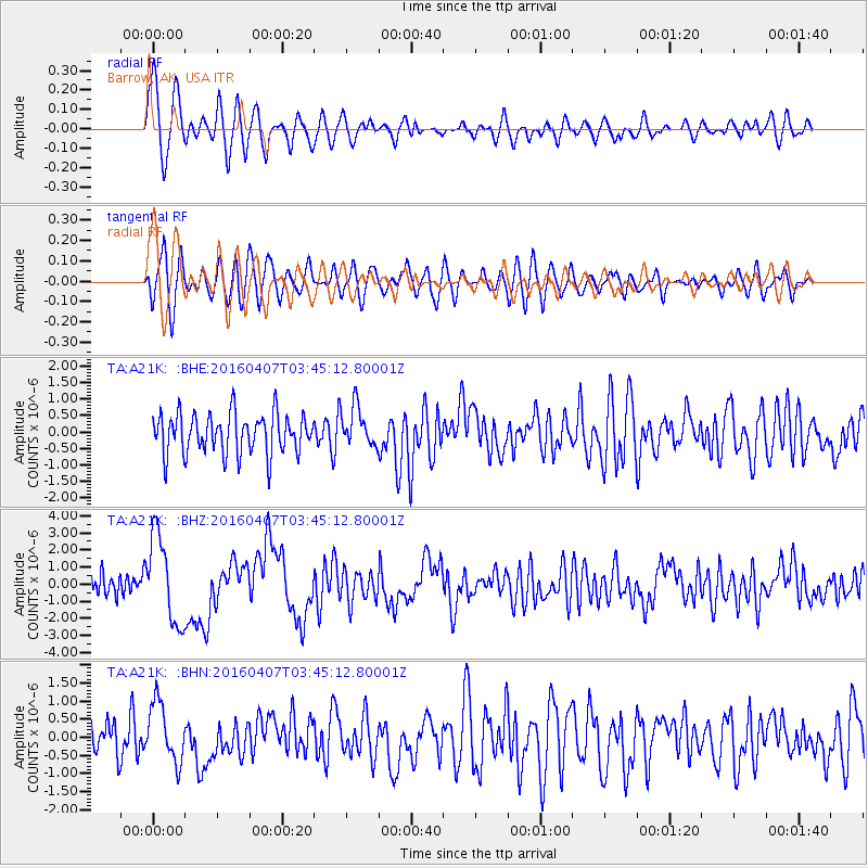
A21K Barrow, AK, USA - Earthquake Result Viewer
*The percent match for this event was below the threshold and hence no stack was calculated.
| Earthquake location: |
Vanuatu Islands |
| Earthquake latitude/longitude: |
-14.0/166.6 |
| Earthquake time(UTC): |
2016/04/07 (098) 03:32:53 GMT |
| Earthquake Depth: |
27 km |
| Earthquake Magnitude: |
6.7 MWW, 6.5 MWB, 6.9 MI |
| Earthquake Catalog/Contributor: |
NEIC PDE/NEIC COMCAT |
|
| Network: |
TA USArray Transportable Network (new EarthScope stations) |
| Station: |
A21K Barrow, AK, USA |
| Lat/Lon: |
71.32 N/156.62 W |
| Elevation: |
577 m |
|
| Distance: |
88.7 deg |
| Az: |
11.134 deg |
| Baz: |
215.576 deg |
| Ray Param: |
$rayparam |
*The percent match for this event was below the threshold and hence was not used in the summary stack. |
|
| Radial Match: |
78.00339 % |
| Radial Bump: |
400 |
| Transverse Match: |
62.521526 % |
| Transverse Bump: |
400 |
| SOD ConfigId: |
7422571 |
| Insert Time: |
2019-04-22 04:22:08.447 +0000 |
| GWidth: |
2.5 |
| Max Bumps: |
400 |
| Tol: |
0.001 |
|
Signal To Noise
| Channel | StoN | STA | LTA |
| TA:A21K: :BHZ:20160407T03:45:12.80001Z | 2.9757638 | 2.553954E-6 | 8.5825155E-7 |
| TA:A21K: :BHN:20160407T03:45:12.80001Z | 1.4578838 | 8.256571E-7 | 5.6633945E-7 |
| TA:A21K: :BHE:20160407T03:45:12.80001Z | 0.99480236 | 6.0108505E-7 | 6.042256E-7 |
| Arrivals |
| Ps | |
| PpPs | |
| PsPs/PpSs | |


