You are here: Home > Network List > TA - USArray Transportable Network (new EarthScope stations) Stations List
> Station T25A Trinidad, CO, USA > Earthquake Result Viewer
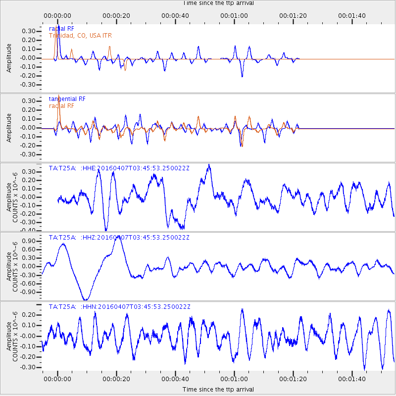
T25A Trinidad, CO, USA - Earthquake Result Viewer
*The percent match for this event was below the threshold and hence no stack was calculated.
| Earthquake location: |
Vanuatu Islands |
| Earthquake latitude/longitude: |
-14.0/166.6 |
| Earthquake time(UTC): |
2016/04/07 (098) 03:32:53 GMT |
| Earthquake Depth: |
27 km |
| Earthquake Magnitude: |
6.7 MWW, 6.5 MWB, 6.9 MI |
| Earthquake Catalog/Contributor: |
NEIC PDE/NEIC COMCAT |
|
| Network: |
TA USArray Transportable Network (new EarthScope stations) |
| Station: |
T25A Trinidad, CO, USA |
| Lat/Lon: |
37.14 N/104.41 W |
| Elevation: |
2017 m |
|
| Distance: |
97.5 deg |
| Az: |
53.704 deg |
| Baz: |
258.241 deg |
| Ray Param: |
$rayparam |
*The percent match for this event was below the threshold and hence was not used in the summary stack. |
|
| Radial Match: |
66.92352 % |
| Radial Bump: |
286 |
| Transverse Match: |
60.27189 % |
| Transverse Bump: |
400 |
| SOD ConfigId: |
7422571 |
| Insert Time: |
2019-04-22 04:22:56.482 +0000 |
| GWidth: |
2.5 |
| Max Bumps: |
400 |
| Tol: |
0.001 |
|
Signal To Noise
| Channel | StoN | STA | LTA |
| TA:T25A: :HHZ:20160407T03:45:53.250022Z | 4.3390303 | 5.733402E-7 | 1.3213555E-7 |
| TA:T25A: :HHN:20160407T03:45:53.250022Z | 0.6417895 | 6.295887E-8 | 9.809894E-8 |
| TA:T25A: :HHE:20160407T03:45:53.250022Z | 1.3218375 | 1.92344E-7 | 1.4551259E-7 |
| Arrivals |
| Ps | |
| PpPs | |
| PsPs/PpSs | |


