MIAR Mount Ida, Arkansas, USA - Earthquake Result Viewer
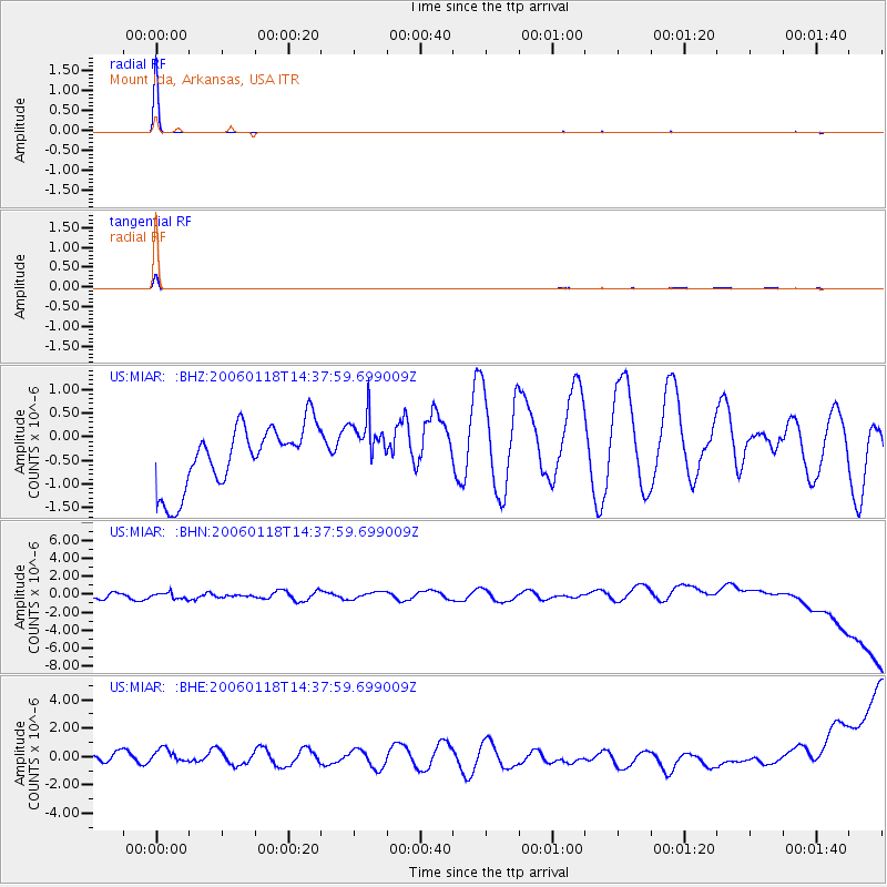
Earthquake location: Off East Coast Of Honshu, Japan
Earthquake latitude/longitude: 37.8/142.1
Earthquake time(UTC): 2006/01/18 (018) 14:25:27 GMT
Earthquake Depth: 26 km
Earthquake Magnitude: 5.8 MB, 5.0 MS, 5.7 MW, 5.5 MW
Earthquake Catalog/Contributor: WHDF/NEIC
Network: US United States National Seismic Network
Station: MIAR Mount Ida, Arkansas, USA
Lat/Lon: 34.55 N/93.58 W
Elevation: 207 m
Distance: 91.4 deg
Az: 43.013 deg
Baz: 319.09 deg
Ray Param: 0.041602988
Estimated Moho Depth: 10.0 km
Estimated Crust Vp/Vs: 1.60
Assumed Crust Vp: 6.498 km/s
Estimated Crust Vs: 4.061 km/s
Estimated Crust Poisson's Ratio: 0.18
Radial Match: 99.497635 %
Radial Bump: 17
Transverse Match: 97.77068 %
Transverse Bump: 57
SOD ConfigId: 2669
Insert Time: 2010-03-05 01:05:28.824 +0000
GWidth: 2.5
Max Bumps: 400
Tol: 0.001

Signal To Noise

ChannelStoNSTALTA
US:MIAR: :BHN:20060118T14:37:59.699009Z0.8349335.993004E-77.1778265E-7
US:MIAR: :BHE:20060118T14:37:59.699009Z1.46213786.8851506E-74.7089614E-7
US:MIAR: :BHZ:20060118T14:37:59.699009Z0.89786495.929046E-76.603495E-7
Arrivals
Ps0.9 SECOND
PpPs3.9 SECOND
PsPs/PpSs4.9 SECOND