You are here: Home > Network List > US - United States National Seismic Network Stations List
> Station AMTX Amarillo, Texas, USA > Earthquake Result Viewer
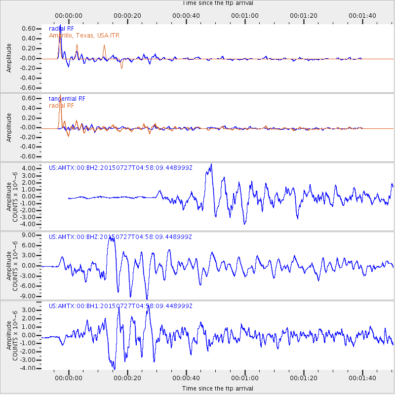
AMTX Amarillo, Texas, USA - Earthquake Result Viewer
*The percent match for this event was below the threshold and hence no stack was calculated.
| Earthquake location: |
Fox Islands, Aleutian Islands |
| Earthquake latitude/longitude: |
52.4/-169.7 |
| Earthquake time(UTC): |
2015/07/27 (208) 04:49:44 GMT |
| Earthquake Depth: |
12 km |
| Earthquake Magnitude: |
6.9 MO |
| Earthquake Catalog/Contributor: |
NEIC PDE/NEIC ALERT |
|
| Network: |
US United States National Seismic Network |
| Station: |
AMTX Amarillo, Texas, USA |
| Lat/Lon: |
34.53 N/101.41 W |
| Elevation: |
1010 m |
|
| Distance: |
50.7 deg |
| Az: |
82.261 deg |
| Baz: |
312.626 deg |
| Ray Param: |
$rayparam |
*The percent match for this event was below the threshold and hence was not used in the summary stack. |
|
| Radial Match: |
98.05982 % |
| Radial Bump: |
342 |
| Transverse Match: |
85.27262 % |
| Transverse Bump: |
400 |
| SOD ConfigId: |
1085051 |
| Insert Time: |
2015-08-10 05:19:01.267 +0000 |
| GWidth: |
2.5 |
| Max Bumps: |
400 |
| Tol: |
0.001 |
|
Signal To Noise
| Channel | StoN | STA | LTA |
| US:AMTX:00:BHZ:20150727T04:58:09.448999Z | 19.59695 | 1.2150309E-6 | 6.2001014E-8 |
| US:AMTX:00:BH1:20150727T04:58:09.448999Z | 2.9878142 | 3.3491102E-7 | 1.12092316E-7 |
| US:AMTX:00:BH2:20150727T04:58:09.448999Z | 5.823135 | 4.1163958E-7 | 7.0690376E-8 |
| Arrivals |
| Ps | |
| PpPs | |
| PsPs/PpSs | |


