You are here: Home > Network List > US - United States National Seismic Network Stations List
> Station MIAR Mount Ida, Arkansas, USA > Earthquake Result Viewer
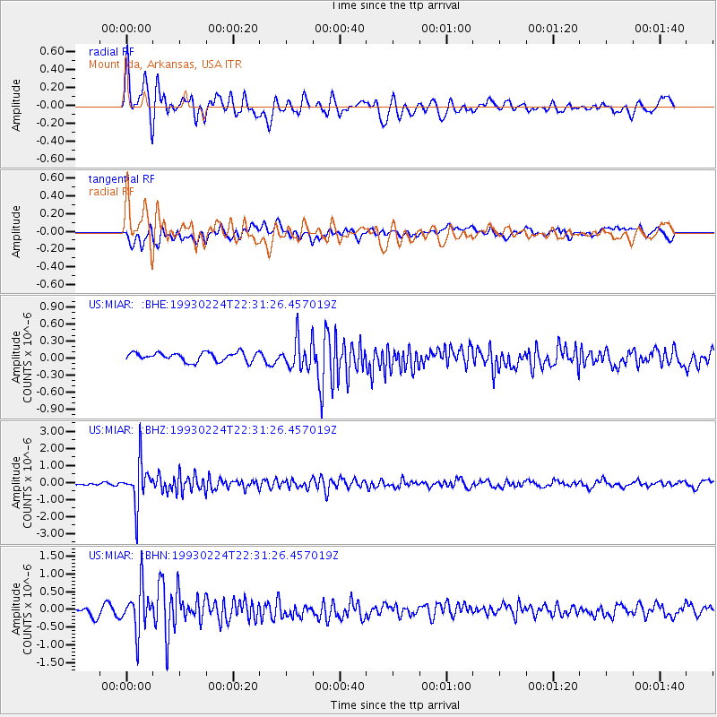
MIAR Mount Ida, Arkansas, USA - Earthquake Result Viewer
*The percent match for this event was below the threshold and hence no stack was calculated.
| Earthquake location: |
Chile-Argentina Border Region |
| Earthquake latitude/longitude: |
-24.9/-68.4 |
| Earthquake time(UTC): |
1993/02/24 (055) 22:21:37 GMT |
| Earthquake Depth: |
117 km |
| Earthquake Magnitude: |
6.0 MB, 5.9 UNKNOWN |
| Earthquake Catalog/Contributor: |
WHDF/NEIC |
|
| Network: |
US United States National Seismic Network |
| Station: |
MIAR Mount Ida, Arkansas, USA |
| Lat/Lon: |
34.55 N/93.58 W |
| Elevation: |
207 m |
|
| Distance: |
63.8 deg |
| Az: |
336.94 deg |
| Baz: |
154.474 deg |
| Ray Param: |
$rayparam |
*The percent match for this event was below the threshold and hence was not used in the summary stack. |
|
| Radial Match: |
75.66207 % |
| Radial Bump: |
400 |
| Transverse Match: |
64.62989 % |
| Transverse Bump: |
400 |
| SOD ConfigId: |
4480 |
| Insert Time: |
2010-03-05 01:05:50.021 +0000 |
| GWidth: |
2.5 |
| Max Bumps: |
400 |
| Tol: |
0.001 |
|
Signal To Noise
| Channel | StoN | STA | LTA |
| US:MIAR: :BHZ:19930224T22:31:26.457019Z | 17.783113 | 1.2382792E-6 | 6.963231E-8 |
| US:MIAR: :BHN:19930224T22:31:26.457019Z | 5.535478 | 6.191349E-7 | 1.11848486E-7 |
| US:MIAR: :BHE:19930224T22:31:26.457019Z | 3.3390315 | 2.60897E-7 | 7.813553E-8 |
| Arrivals |
| Ps | |
| PpPs | |
| PsPs/PpSs | |


