You are here: Home > Network List > US - United States National Seismic Network Stations List
> Station MIAR Mount Ida, Arkansas, USA > Earthquake Result Viewer
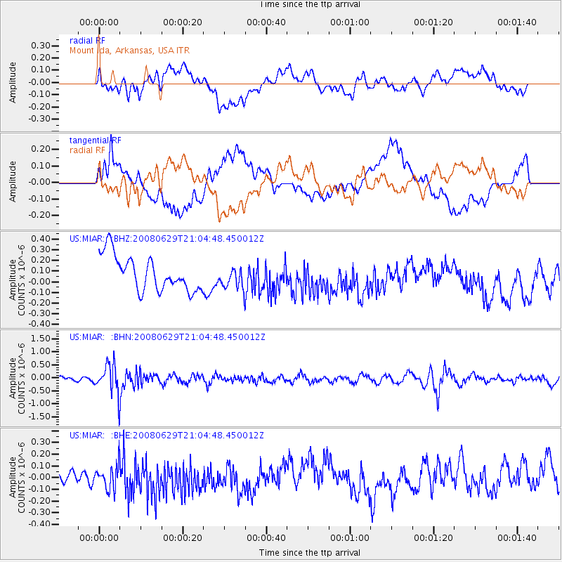
MIAR Mount Ida, Arkansas, USA - Earthquake Result Viewer
*The percent match for this event was below the threshold and hence no stack was calculated.
| Earthquake location: |
Primor'ye, Russia |
| Earthquake latitude/longitude: |
45.2/137.4 |
| Earthquake time(UTC): |
2008/06/29 (181) 20:53:01 GMT |
| Earthquake Depth: |
287 km |
| Earthquake Magnitude: |
5.6 MB, 6.0 MW, 5.9 MW |
| Earthquake Catalog/Contributor: |
WHDF/NEIC |
|
| Network: |
US United States National Seismic Network |
| Station: |
MIAR Mount Ida, Arkansas, USA |
| Lat/Lon: |
34.55 N/93.58 W |
| Elevation: |
207 m |
|
| Distance: |
88.2 deg |
| Az: |
39.926 deg |
| Baz: |
326.627 deg |
| Ray Param: |
$rayparam |
*The percent match for this event was below the threshold and hence was not used in the summary stack. |
|
| Radial Match: |
39.526417 % |
| Radial Bump: |
400 |
| Transverse Match: |
36.223186 % |
| Transverse Bump: |
400 |
| SOD ConfigId: |
2504 |
| Insert Time: |
2010-03-05 01:05:51.950 +0000 |
| GWidth: |
2.5 |
| Max Bumps: |
400 |
| Tol: |
0.001 |
|
Signal To Noise
| Channel | StoN | STA | LTA |
| US:MIAR: :BHN:20080629T21:04:48.450012Z | 6.037096 | 5.6958373E-7 | 9.43473E-8 |
| US:MIAR: :BHE:20080629T21:04:48.450012Z | 0.95324135 | 1.0128417E-7 | 1.06252386E-7 |
| US:MIAR: :BHZ:20080629T21:04:48.450012Z | 0.6495066 | 1.056469E-7 | 1.6265714E-7 |
| Arrivals |
| Ps | |
| PpPs | |
| PsPs/PpSs | |


