You are here: Home > Network List > US - United States National Seismic Network Stations List
> Station MIAR Mount Ida, Arkansas, USA > Earthquake Result Viewer
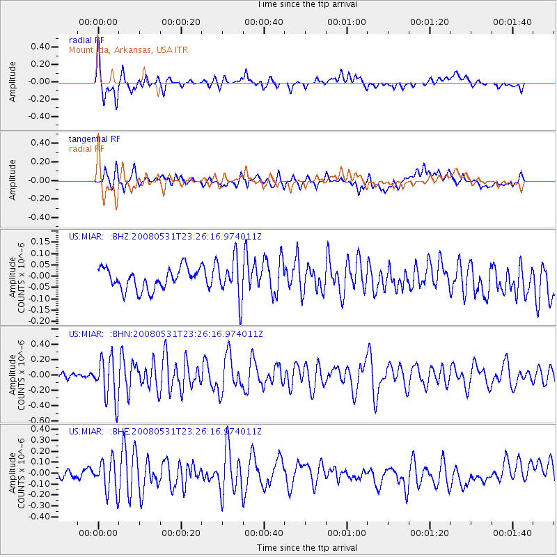
MIAR Mount Ida, Arkansas, USA - Earthquake Result Viewer
*The percent match for this event was below the threshold and hence no stack was calculated.
| Earthquake location: |
Easter Island Region |
| Earthquake latitude/longitude: |
-28.9/-112.3 |
| Earthquake time(UTC): |
2008/05/31 (152) 23:16:04 GMT |
| Earthquake Depth: |
10 km |
| Earthquake Magnitude: |
5.5 MS, 5.4 MB, 5.8 MW, 5.8 MW |
| Earthquake Catalog/Contributor: |
WHDF/NEIC |
|
| Network: |
US United States National Seismic Network |
| Station: |
MIAR Mount Ida, Arkansas, USA |
| Lat/Lon: |
34.55 N/93.58 W |
| Elevation: |
207 m |
|
| Distance: |
65.5 deg |
| Az: |
16.885 deg |
| Baz: |
197.967 deg |
| Ray Param: |
$rayparam |
*The percent match for this event was below the threshold and hence was not used in the summary stack. |
|
| Radial Match: |
71.28049 % |
| Radial Bump: |
400 |
| Transverse Match: |
52.826378 % |
| Transverse Bump: |
400 |
| SOD ConfigId: |
2504 |
| Insert Time: |
2010-03-05 01:06:25.022 +0000 |
| GWidth: |
2.5 |
| Max Bumps: |
400 |
| Tol: |
0.001 |
|
Signal To Noise
| Channel | StoN | STA | LTA |
| US:MIAR: :BHN:20080531T23:26:16.974011Z | 5.5730453 | 2.8988362E-7 | 5.2015302E-8 |
| US:MIAR: :BHE:20080531T23:26:16.974011Z | 2.420224 | 1.5510973E-7 | 6.4089E-8 |
| US:MIAR: :BHZ:20080531T23:26:16.974011Z | 1.9314091 | 8.974029E-8 | 4.6463636E-8 |
| Arrivals |
| Ps | |
| PpPs | |
| PsPs/PpSs | |


