You are here: Home > Network List > US - United States National Seismic Network Stations List
> Station MIAR Mount Ida, Arkansas, USA > Earthquake Result Viewer
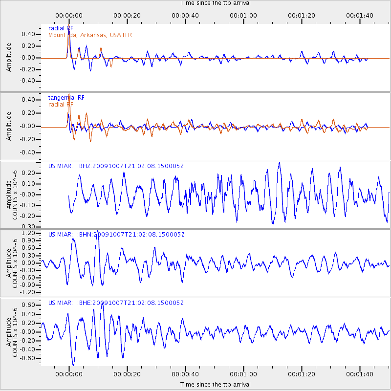
MIAR Mount Ida, Arkansas, USA - Earthquake Result Viewer
*The percent match for this event was below the threshold and hence no stack was calculated.
| Earthquake location: |
East Of Severnaya Zemlya |
| Earthquake latitude/longitude: |
81.6/119.5 |
| Earthquake time(UTC): |
2009/10/07 (280) 20:52:13 GMT |
| Earthquake Depth: |
8.0 km |
| Earthquake Magnitude: |
5.7 MB, 5.1 MS, 5.8 MW, 5.8 MW |
| Earthquake Catalog/Contributor: |
WHDF/NEIC |
|
| Network: |
US United States National Seismic Network |
| Station: |
MIAR Mount Ida, Arkansas, USA |
| Lat/Lon: |
34.55 N/93.58 W |
| Elevation: |
207 m |
|
| Distance: |
62.9 deg |
| Az: |
30.446 deg |
| Baz: |
354.804 deg |
| Ray Param: |
$rayparam |
*The percent match for this event was below the threshold and hence was not used in the summary stack. |
|
| Radial Match: |
70.94507 % |
| Radial Bump: |
380 |
| Transverse Match: |
59.644585 % |
| Transverse Bump: |
400 |
| SOD ConfigId: |
2622 |
| Insert Time: |
2010-03-05 01:07:13.208 +0000 |
| GWidth: |
2.5 |
| Max Bumps: |
400 |
| Tol: |
0.001 |
|
Signal To Noise
| Channel | StoN | STA | LTA |
| US:MIAR: :BHN:20091007T21:02:08.150005Z | 5.3116717 | 6.156109E-7 | 1.1589777E-7 |
| US:MIAR: :BHE:20091007T21:02:08.150005Z | 2.8624575 | 3.8396684E-7 | 1.3413889E-7 |
| US:MIAR: :BHZ:20091007T21:02:08.150005Z | 0.9794334 | 8.905186E-8 | 9.092181E-8 |
| Arrivals |
| Ps | |
| PpPs | |
| PsPs/PpSs | |


