You are here: Home > Network List > US - United States National Seismic Network Stations List
> Station MIAR Mount Ida, Arkansas, USA > Earthquake Result Viewer
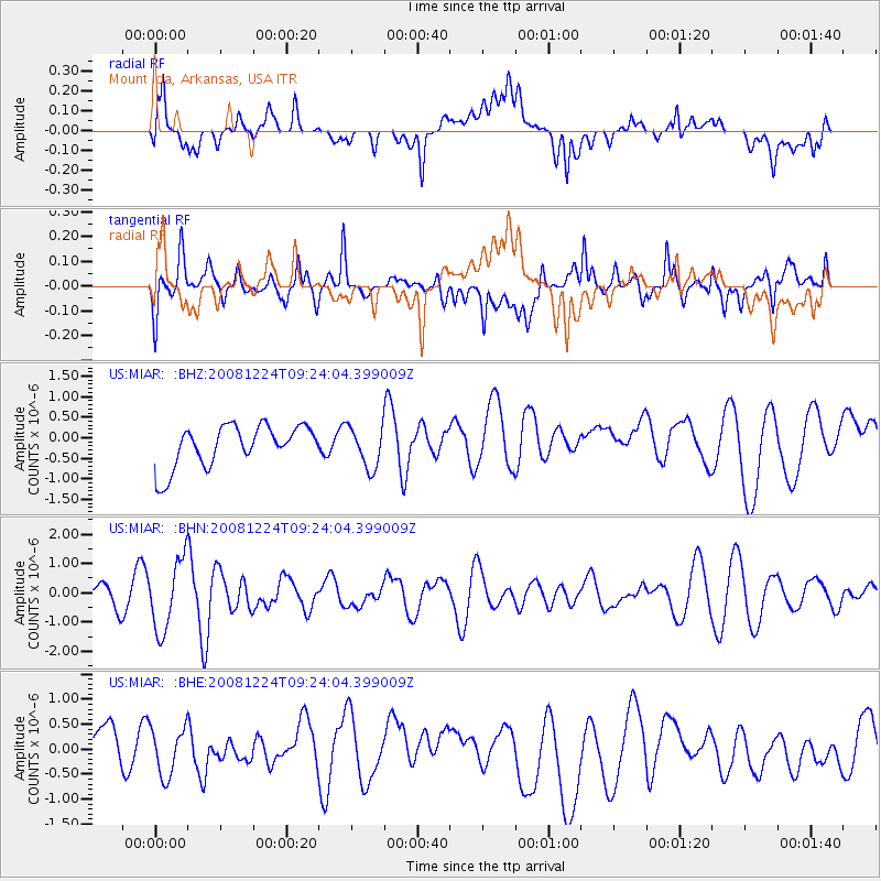
MIAR Mount Ida, Arkansas, USA - Earthquake Result Viewer
*The percent match for this event was below the threshold and hence no stack was calculated.
| Earthquake location: |
Tonga Islands Region |
| Earthquake latitude/longitude: |
-17.3/-171.9 |
| Earthquake time(UTC): |
2008/12/24 (359) 09:11:34 GMT |
| Earthquake Depth: |
9.0 km |
| Earthquake Magnitude: |
5.9 MB, 5.6 MS, 6.0 MW, 6.0 MW |
| Earthquake Catalog/Contributor: |
WHDF/NEIC |
|
| Network: |
US United States National Seismic Network |
| Station: |
MIAR Mount Ida, Arkansas, USA |
| Lat/Lon: |
34.55 N/93.58 W |
| Elevation: |
207 m |
|
| Distance: |
90.4 deg |
| Az: |
53.941 deg |
| Baz: |
249.335 deg |
| Ray Param: |
$rayparam |
*The percent match for this event was below the threshold and hence was not used in the summary stack. |
|
| Radial Match: |
46.369473 % |
| Radial Bump: |
400 |
| Transverse Match: |
60.307693 % |
| Transverse Bump: |
400 |
| SOD ConfigId: |
2658 |
| Insert Time: |
2010-03-05 01:07:45.246 +0000 |
| GWidth: |
2.5 |
| Max Bumps: |
400 |
| Tol: |
0.001 |
|
Signal To Noise
| Channel | StoN | STA | LTA |
| US:MIAR: :BHN:20081224T09:24:04.399009Z | 2.3789277 | 1.2042323E-6 | 5.0620804E-7 |
| US:MIAR: :BHE:20081224T09:24:04.399009Z | 0.8893497 | 4.880882E-7 | 5.488147E-7 |
| US:MIAR: :BHZ:20081224T09:24:04.399009Z | 0.9977864 | 4.9970765E-7 | 5.0081627E-7 |
| Arrivals |
| Ps | |
| PpPs | |
| PsPs/PpSs | |


