You are here: Home > Network List > CI - Caltech Regional Seismic Network Stations List
> Station BAR Barrett, Tecate, CA, USA > Earthquake Result Viewer
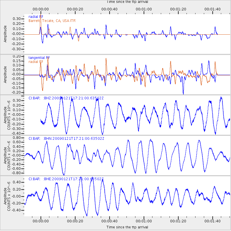
BAR Barrett, Tecate, CA, USA - Earthquake Result Viewer
*The percent match for this event was below the threshold and hence no stack was calculated.
| Earthquake location: |
Southeast Of Loyalty Islands |
| Earthquake latitude/longitude: |
-22.7/171.0 |
| Earthquake time(UTC): |
2009/01/21 (021) 17:08:42 GMT |
| Earthquake Depth: |
24 km |
| Earthquake Magnitude: |
5.8 MS, 5.4 MB, 6.1 MW, 6.1 MW |
| Earthquake Catalog/Contributor: |
WHDF/NEIC |
|
| Network: |
CI Caltech Regional Seismic Network |
| Station: |
BAR Barrett, Tecate, CA, USA |
| Lat/Lon: |
32.68 N/116.67 W |
| Elevation: |
521 m |
|
| Distance: |
88.2 deg |
| Az: |
53.488 deg |
| Baz: |
241.661 deg |
| Ray Param: |
$rayparam |
*The percent match for this event was below the threshold and hence was not used in the summary stack. |
|
| Radial Match: |
59.718746 % |
| Radial Bump: |
310 |
| Transverse Match: |
62.163986 % |
| Transverse Bump: |
400 |
| SOD ConfigId: |
2834 |
| Insert Time: |
2010-02-26 00:13:05.936 +0000 |
| GWidth: |
2.5 |
| Max Bumps: |
400 |
| Tol: |
0.001 |
|
Signal To Noise
| Channel | StoN | STA | LTA |
| CI:BAR: :BHN:20090121T17:21:00.63502Z | 1.3709521 | 3.3599403E-7 | 2.4508077E-7 |
| CI:BAR: :BHE:20090121T17:21:00.63502Z | 1.0885472 | 1.7452443E-7 | 1.6032786E-7 |
| CI:BAR: :BHZ:20090121T17:21:00.63502Z | 1.0923592 | 2.2362167E-7 | 2.0471442E-7 |
| Arrivals |
| Ps | |
| PpPs | |
| PsPs/PpSs | |


