You are here: Home > Network List > CI - Caltech Regional Seismic Network Stations List
> Station BAR Barrett, Tecate, CA, USA > Earthquake Result Viewer
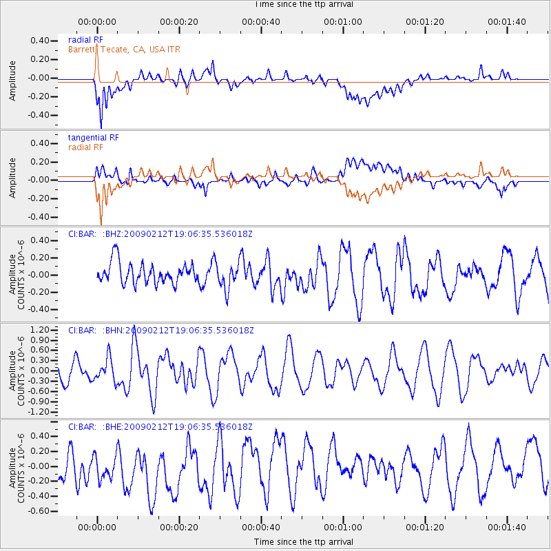
BAR Barrett, Tecate, CA, USA - Earthquake Result Viewer
*The percent match for this event was below the threshold and hence no stack was calculated.
| Earthquake location: |
Kermadec Islands Region |
| Earthquake latitude/longitude: |
-31.2/-178.1 |
| Earthquake time(UTC): |
2009/02/12 (043) 18:54:28 GMT |
| Earthquake Depth: |
24 km |
| Earthquake Magnitude: |
5.6 MB, 5.6 MS, 5.9 MW, 5.8 MW |
| Earthquake Catalog/Contributor: |
WHDF/NEIC |
|
| Network: |
CI Caltech Regional Seismic Network |
| Station: |
BAR Barrett, Tecate, CA, USA |
| Lat/Lon: |
32.68 N/116.67 W |
| Elevation: |
521 m |
|
| Distance: |
86.1 deg |
| Az: |
47.939 deg |
| Baz: |
228.949 deg |
| Ray Param: |
$rayparam |
*The percent match for this event was below the threshold and hence was not used in the summary stack. |
|
| Radial Match: |
67.436714 % |
| Radial Bump: |
400 |
| Transverse Match: |
66.49581 % |
| Transverse Bump: |
400 |
| SOD ConfigId: |
2658 |
| Insert Time: |
2010-02-26 00:13:06.818 +0000 |
| GWidth: |
2.5 |
| Max Bumps: |
400 |
| Tol: |
0.001 |
|
Signal To Noise
| Channel | StoN | STA | LTA |
| CI:BAR: :BHN:20090212T19:06:35.536018Z | 0.9290221 | 3.4768794E-7 | 3.7425153E-7 |
| CI:BAR: :BHE:20090212T19:06:35.536018Z | 0.7790734 | 3.525168E-7 | 4.524821E-7 |
| CI:BAR: :BHZ:20090212T19:06:35.536018Z | 1.2968756 | 1.5358103E-7 | 1.1842387E-7 |
| Arrivals |
| Ps | |
| PpPs | |
| PsPs/PpSs | |


