You are here: Home > Network List > UW - Pacific Northwest Regional Seismic Network Stations List
> Station PASS Maple Falls, WA, USA > Earthquake Result Viewer
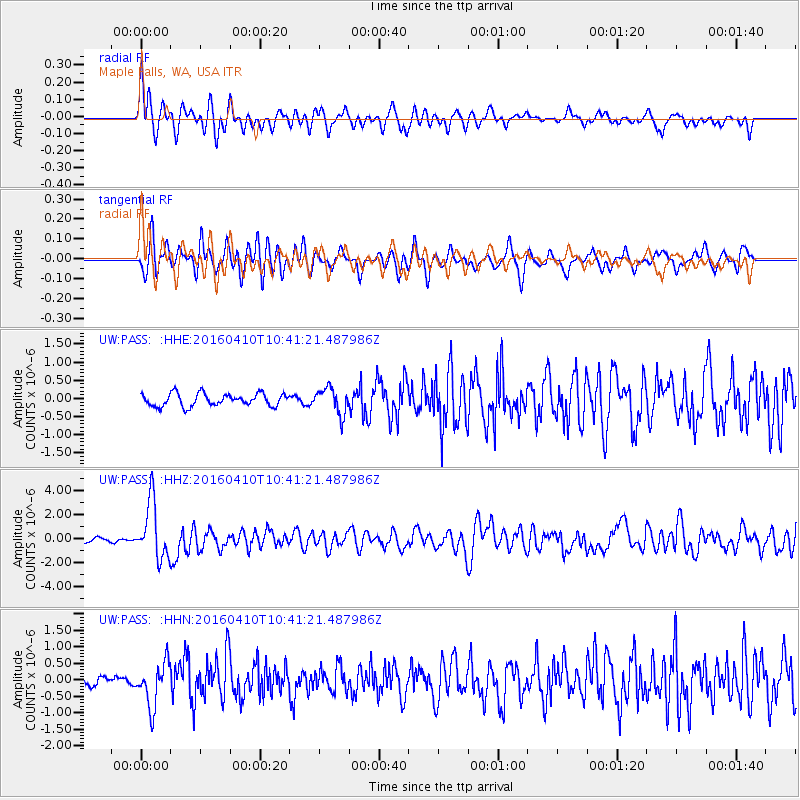
PASS Maple Falls, WA, USA - Earthquake Result Viewer
*The percent match for this event was below the threshold and hence no stack was calculated.
| Earthquake location: |
Afghanistan-Tajikistan Bord Reg. |
| Earthquake latitude/longitude: |
36.5/71.2 |
| Earthquake time(UTC): |
2016/04/10 (101) 10:28:58 GMT |
| Earthquake Depth: |
210 km |
| Earthquake Magnitude: |
6.6 MWB |
| Earthquake Catalog/Contributor: |
NEIC PDE/NEIC COMCAT |
|
| Network: |
UW Pacific Northwest Regional Seismic Network |
| Station: |
PASS Maple Falls, WA, USA |
| Lat/Lon: |
49.00 N/122.09 W |
| Elevation: |
174 m |
|
| Distance: |
94.1 deg |
| Az: |
8.699 deg |
| Baz: |
349.336 deg |
| Ray Param: |
$rayparam |
*The percent match for this event was below the threshold and hence was not used in the summary stack. |
|
| Radial Match: |
72.10665 % |
| Radial Bump: |
400 |
| Transverse Match: |
56.476433 % |
| Transverse Bump: |
400 |
| SOD ConfigId: |
7422571 |
| Insert Time: |
2019-04-22 04:46:09.940 +0000 |
| GWidth: |
2.5 |
| Max Bumps: |
400 |
| Tol: |
0.001 |
|
Signal To Noise
| Channel | StoN | STA | LTA |
| UW:PASS: :HHZ:20160410T10:41:21.487986Z | 12.4790945 | 2.3380496E-6 | 1.873573E-7 |
| UW:PASS: :HHN:20160410T10:41:21.487986Z | 4.4892006 | 6.6799197E-7 | 1.4879976E-7 |
| UW:PASS: :HHE:20160410T10:41:21.487986Z | 2.0543737 | 3.5466385E-7 | 1.7263844E-7 |
| Arrivals |
| Ps | |
| PpPs | |
| PsPs/PpSs | |


