ERPA Erie, Pennsylvania, USA - Earthquake Result Viewer
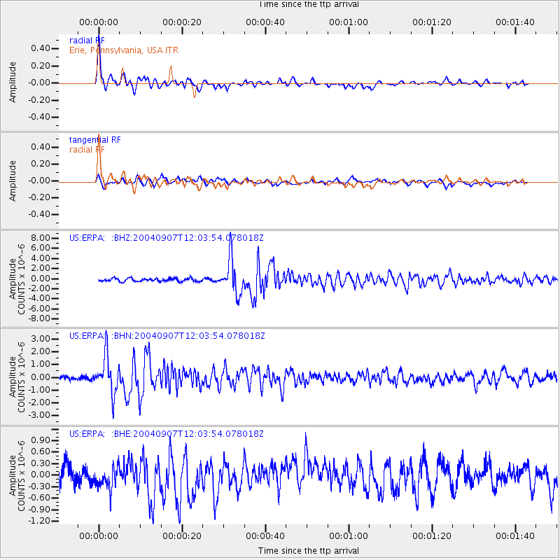
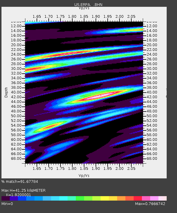
Earthquake location: Santiago Del Estero Prov., Arg.
Earthquake latitude/longitude: -28.6/-65.8
Earthquake time(UTC): 2004/09/07 (251) 11:53:06 GMT
Earthquake Depth: 22 km
Earthquake Magnitude: 6.1 MB, 6.1 MS, 6.4 MW, 6.2 MW
Earthquake Catalog/Contributor: WHDF/NEIC
Network: US United States National Seismic Network
Station: ERPA Erie, Pennsylvania, USA
Lat/Lon: 42.12 N/79.99 W
Elevation: 306 m
Distance: 71.5 deg
Az: 348.946 deg
Baz: 166.899 deg
Ray Param: 0.05423404
Estimated Moho Depth: 41.25 km
Estimated Crust Vp/Vs: 1.92
Assumed Crust Vp: 6.419 km/s
Estimated Crust Vs: 3.343 km/s
Estimated Crust Poisson's Ratio: 0.31
Radial Match: 91.67784 %
Radial Bump: 400
Transverse Match: 61.06201 %
Transverse Bump: 400
SOD ConfigId: 110177
Insert Time: 2010-03-05 01:10:19.305 +0000
GWidth: 2.5
Max Bumps: 400
Tol: 0.001

Signal To Noise

ChannelStoNSTALTA
US:ERPA: :BHN:20040907T12:03:54.078018Z8.8244221.4926918E-61.6915463E-7
US:ERPA: :BHE:20040907T12:03:54.078018Z0.970916454.0402819E-74.1613075E-7
US:ERPA: :BHZ:20040907T12:03:54.078018Z11.8280743.553582E-63.0043623E-7
Arrivals
Ps6.1 SECOND
PpPs18 SECOND
PsPs/PpSs24 SECOND