ERPA Erie, Pennsylvania, USA - Earthquake Result Viewer
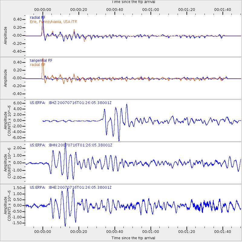
Earthquake location: Near West Coast Of Honshu, Japan
Earthquake latitude/longitude: 37.5/138.4
Earthquake time(UTC): 2007/07/16 (197) 01:13:22 GMT
Earthquake Depth: 12 km
Earthquake Magnitude: 6.5 MB, 6.4 MS, 6.6 MW, 6.5 MW
Earthquake Catalog/Contributor: WHDF/NEIC
Network: US United States National Seismic Network
Station: ERPA Erie, Pennsylvania, USA
Lat/Lon: 42.12 N/79.99 W
Elevation: 306 m
Distance: 93.3 deg
Az: 27.599 deg
Baz: 330.331 deg
Ray Param: 0.041282985
Estimated Moho Depth: 21.75 km
Estimated Crust Vp/Vs: 1.76
Assumed Crust Vp: 6.419 km/s
Estimated Crust Vs: 3.637 km/s
Estimated Crust Poisson's Ratio: 0.26
Radial Match: 96.75938 %
Radial Bump: 326
Transverse Match: 75.48239 %
Transverse Bump: 400
SOD ConfigId: 2564
Insert Time: 2010-03-05 01:10:44.451 +0000
GWidth: 2.5
Max Bumps: 400
Tol: 0.001

Signal To Noise

ChannelStoNSTALTA
US:ERPA: :BHN:20070716T01:26:05.38001Z6.6300145.091182E-77.678992E-8
US:ERPA: :BHE:20070716T01:26:05.38001Z2.26503972.2180237E-79.792427E-8
US:ERPA: :BHZ:20070716T01:26:05.38001Z10.3258191.4066428E-61.3622578E-7
Arrivals
Ps2.6 SECOND
PpPs9.2 SECOND
PsPs/PpSs12 SECOND