You are here: Home > Network List > TA - USArray Transportable Network (new EarthScope stations) Stations List
> Station W41B Gary Mavity, Velonia, AR, USA > Earthquake Result Viewer
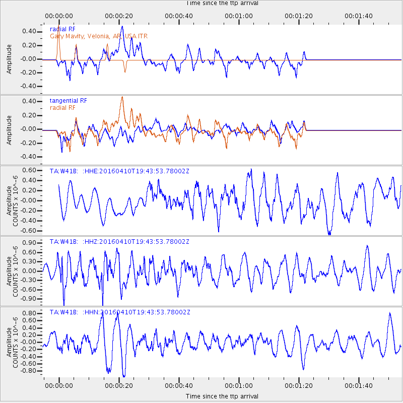
W41B Gary Mavity, Velonia, AR, USA - Earthquake Result Viewer
*The percent match for this event was below the threshold and hence no stack was calculated.
| Earthquake location: |
Rat Islands, Aleutian Islands |
| Earthquake latitude/longitude: |
51.1/179.5 |
| Earthquake time(UTC): |
2016/04/10 (101) 19:34:02 GMT |
| Earthquake Depth: |
19 km |
| Earthquake Magnitude: |
5.6 MWW, 5.3 ML, 5.4 MWB, 5.6 MWC, 5.7 ML |
| Earthquake Catalog/Contributor: |
NEIC PDE/NEIC COMCAT |
|
| Network: |
TA USArray Transportable Network (new EarthScope stations) |
| Station: |
W41B Gary Mavity, Velonia, AR, USA |
| Lat/Lon: |
35.17 N/92.25 W |
| Elevation: |
95 m |
|
| Distance: |
62.5 deg |
| Az: |
67.358 deg |
| Baz: |
314.769 deg |
| Ray Param: |
$rayparam |
*The percent match for this event was below the threshold and hence was not used in the summary stack. |
|
| Radial Match: |
53.77324 % |
| Radial Bump: |
400 |
| Transverse Match: |
59.963497 % |
| Transverse Bump: |
400 |
| SOD ConfigId: |
7422571 |
| Insert Time: |
2019-04-22 04:55:20.905 +0000 |
| GWidth: |
2.5 |
| Max Bumps: |
400 |
| Tol: |
0.001 |
|
Signal To Noise
| Channel | StoN | STA | LTA |
| TA:W41B: :HHZ:20160410T19:43:53.78002Z | 1.5953029 | 4.6010945E-7 | 2.884151E-7 |
| TA:W41B: :HHN:20160410T19:43:53.78002Z | 0.5117178 | 1.3656475E-7 | 2.6687513E-7 |
| TA:W41B: :HHE:20160410T19:43:53.78002Z | 1.4615842 | 2.9641834E-7 | 2.0280619E-7 |
| Arrivals |
| Ps | |
| PpPs | |
| PsPs/PpSs | |


