You are here: Home > Network List > TA - USArray Transportable Network (new EarthScope stations) Stations List
> Station Z41A Richland Creek Farm, El Dorado, AR, USA > Earthquake Result Viewer
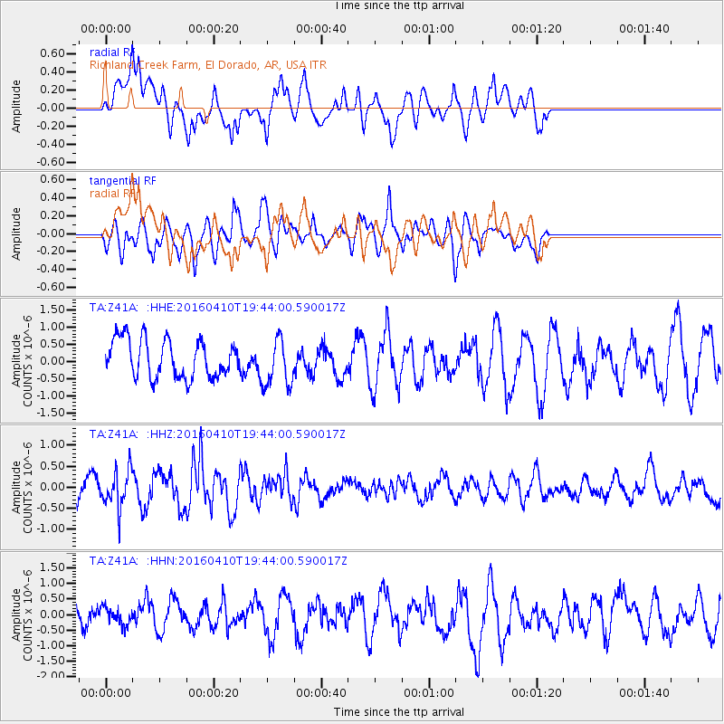
Z41A Richland Creek Farm, El Dorado, AR, USA - Earthquake Result Viewer
*The percent match for this event was below the threshold and hence no stack was calculated.
| Earthquake location: |
Rat Islands, Aleutian Islands |
| Earthquake latitude/longitude: |
51.1/179.5 |
| Earthquake time(UTC): |
2016/04/10 (101) 19:34:02 GMT |
| Earthquake Depth: |
19 km |
| Earthquake Magnitude: |
5.6 MWW, 5.3 ML, 5.4 MWB, 5.6 MWC, 5.7 ML |
| Earthquake Catalog/Contributor: |
NEIC PDE/NEIC COMCAT |
|
| Network: |
TA USArray Transportable Network (new EarthScope stations) |
| Station: |
Z41A Richland Creek Farm, El Dorado, AR, USA |
| Lat/Lon: |
33.26 N/92.80 W |
| Elevation: |
62 m |
|
| Distance: |
63.6 deg |
| Az: |
69.238 deg |
| Baz: |
315.31 deg |
| Ray Param: |
$rayparam |
*The percent match for this event was below the threshold and hence was not used in the summary stack. |
|
| Radial Match: |
54.850273 % |
| Radial Bump: |
400 |
| Transverse Match: |
39.874638 % |
| Transverse Bump: |
380 |
| SOD ConfigId: |
7422571 |
| Insert Time: |
2019-04-22 04:55:23.000 +0000 |
| GWidth: |
2.5 |
| Max Bumps: |
400 |
| Tol: |
0.001 |
|
Signal To Noise
| Channel | StoN | STA | LTA |
| TA:Z41A: :HHZ:20160410T19:44:00.590017Z | 1.4345134 | 4.442131E-7 | 3.0966115E-7 |
| TA:Z41A: :HHN:20160410T19:44:00.590017Z | 0.4331395 | 2.7890155E-7 | 6.4390696E-7 |
| TA:Z41A: :HHE:20160410T19:44:00.590017Z | 1.2619991 | 6.96286E-7 | 5.5173257E-7 |
| Arrivals |
| Ps | |
| PpPs | |
| PsPs/PpSs | |


