ERPA Erie, Pennsylvania, USA - Earthquake Result Viewer
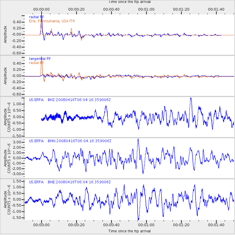
Earthquake location: Andreanof Islands, Aleutian Is.
Earthquake latitude/longitude: 51.9/-179.2
Earthquake time(UTC): 2008/04/16 (107) 05:54:19 GMT
Earthquake Depth: 13 km
Earthquake Magnitude: 6.1 MB, 6.5 MS, 6.6 MW, 6.6 MW
Earthquake Catalog/Contributor: WHDF/NEIC
Network: US United States National Seismic Network
Station: ERPA Erie, Pennsylvania, USA
Lat/Lon: 42.12 N/79.99 W
Elevation: 306 m
Distance: 63.2 deg
Az: 55.368 deg
Baz: 316.72 deg
Ray Param: 0.05971944
Estimated Moho Depth: 23.0 km
Estimated Crust Vp/Vs: 1.80
Assumed Crust Vp: 6.419 km/s
Estimated Crust Vs: 3.561 km/s
Estimated Crust Poisson's Ratio: 0.28
Radial Match: 94.31682 %
Radial Bump: 310
Transverse Match: 55.834995 %
Transverse Bump: 400
SOD ConfigId: 2504
Insert Time: 2010-03-05 01:10:59.272 +0000
GWidth: 2.5
Max Bumps: 400
Tol: 0.001

Signal To Noise

ChannelStoNSTALTA
US:ERPA: :BHN:20080416T06:04:16.359006Z3.32435235.865801E-71.7644943E-7
US:ERPA: :BHE:20080416T06:04:16.359006Z1.12534981.9211507E-71.7071588E-7
US:ERPA: :BHZ:20080416T06:04:16.359006Z1.36163072.2416951E-71.6463312E-7
Arrivals
Ps3.0 SECOND
PpPs9.6 SECOND
PsPs/PpSs13 SECOND