
ERPA Erie, Pennsylvania, USA - Earthquake Result Viewer
| ||||||||||||||||||
| ||||||||||||||||||
| ||||||||||||||||||
|
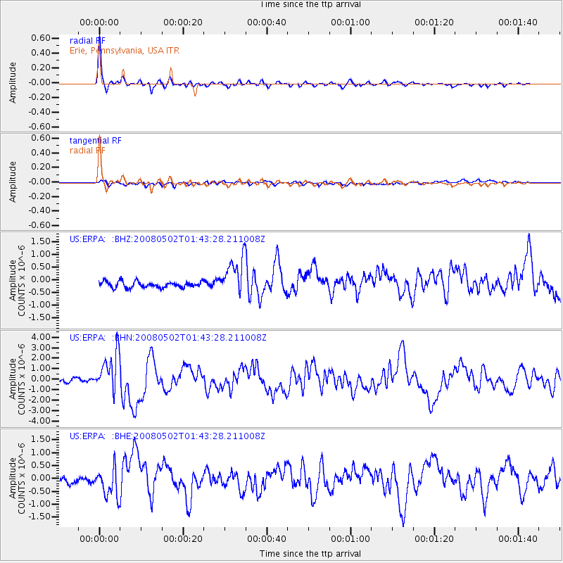
Signal To Noise
| Channel | StoN | STA | LTA |
| US:ERPA: :BHN:20080502T01:43:28.211008Z | 12.968826 | 1.8725326E-6 | 1.443872E-7 |
| US:ERPA: :BHE:20080502T01:43:28.211008Z | 4.753087 | 5.412681E-7 | 1.13877164E-7 |
| US:ERPA: :BHZ:20080502T01:43:28.211008Z | 6.504563 | 7.6682187E-7 | 1.1788983E-7 |
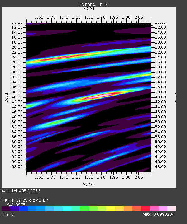
| Arrivals | |
| Ps | 5.7 SECOND |
| PpPs | 17 SECOND |
| PsPs/PpSs | 23 SECOND |

